Copyright © 2026 · All Rights Reserved · Ray's Travels
Swell Lite from Organic Themes · RSS Feed · Log in
Days 2-3 on the river
It probably seems like the blog just kind of disappeared, huh? Well, as you’ll learn I had a hectic trip home and eventually managed to spill a glass of lemonade into my desktop PC, which had all of my pictures on it. Yeah, they are all backed up and I did some acrobatics to get the disks mounted to my server, images transferred to my laptop, etc. Now I’m back up and running again.
I’ve sorted through several hundred pics to share my favorites and will spread them over a few posts to avoid dumping them all at once. I know you will enjoy these but I even more so hope this inspires someone to get out and do a trip of their own to share.
730 miles in length, the Green river originates in northern Wyoming, touches Colorado briefly for 40 miles, winds through Utah and then flows into the Colorado river. We paddled a total of 120 miles with the last few miles being after the confluence with the Colorado, so this is the very southernmost section. The basin (watershed) of the Green River is an intermontane (among/between the mountains) desert roughly 20,000 square miles in size and covers parts of each state in which it flows. In the area we spent our time, the exposed sedimentary rock was deposited around 300 million years ago. Today, surface elevation is 5000 ft due to various uplifts and deposition of rock and sediment by sea ingress/outgress, rain, rivers and wind. The Canyonlands and Arches National Park Visitor’s Centers have great visuals of their best guesses as to how everything came together. Erosion by the Green River took place over some millions of years, exposing this rock along the river to create a window into 300 million years of geologic change. Considering the universe is estimated to be 13 billion years old and earth is put at 4.5 billion years, this 0.3 billion year window creates a context in which you have to think on a very different scale than we encounter in a typical day, month or year. If there was an overarching theme to our trip, this was it. Dozens of times every day we just looked on in awe, speechless.
The general terrain is rocky with various brush, often tamarisk (dang it) and rarely cottonwood trees. Pretty much the only shade you can find is next to a rock or under a cottonwood. Given the movement of the sun, rocks are rarely shade long enough to suffice for a good camp. We spent most of our days in camp reading, hiking, eating or talking so having a well shaded spot was essential. Along most of the river, tamarisk has taken over and grown so thick that you literally can’t get out of a canoe and onto the shore except in very rare spots. This led to one of the focal points of each day being to find a good camp spot. When we found a great spot, we called it a day!
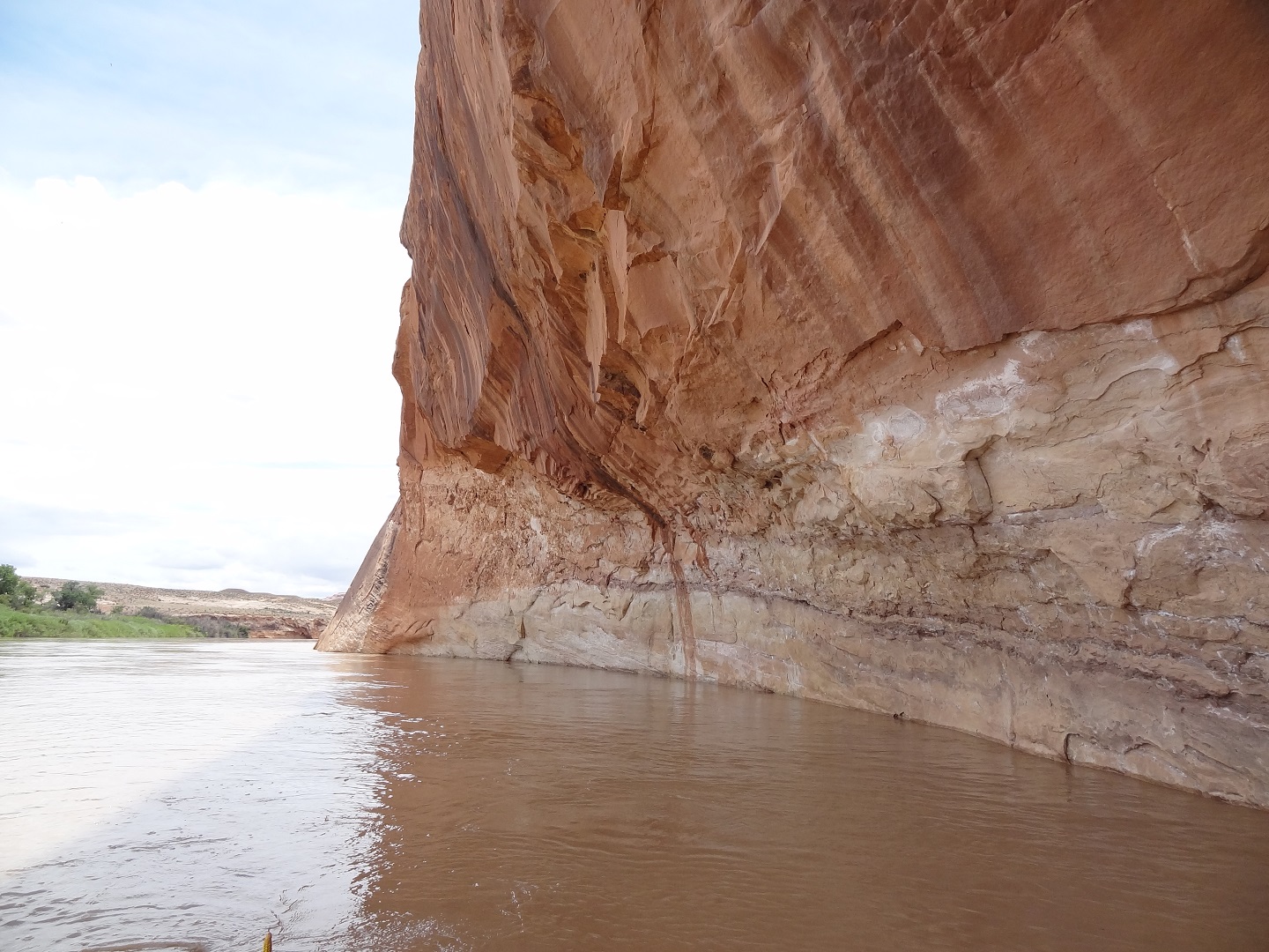
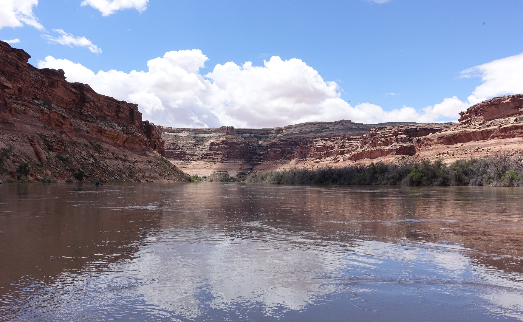
A very typical view along the Green River: sheer wall on one side, open terrain on the other. The walls often have great views of sedimentary layers and we carried guidebooks that described each as we progressed.
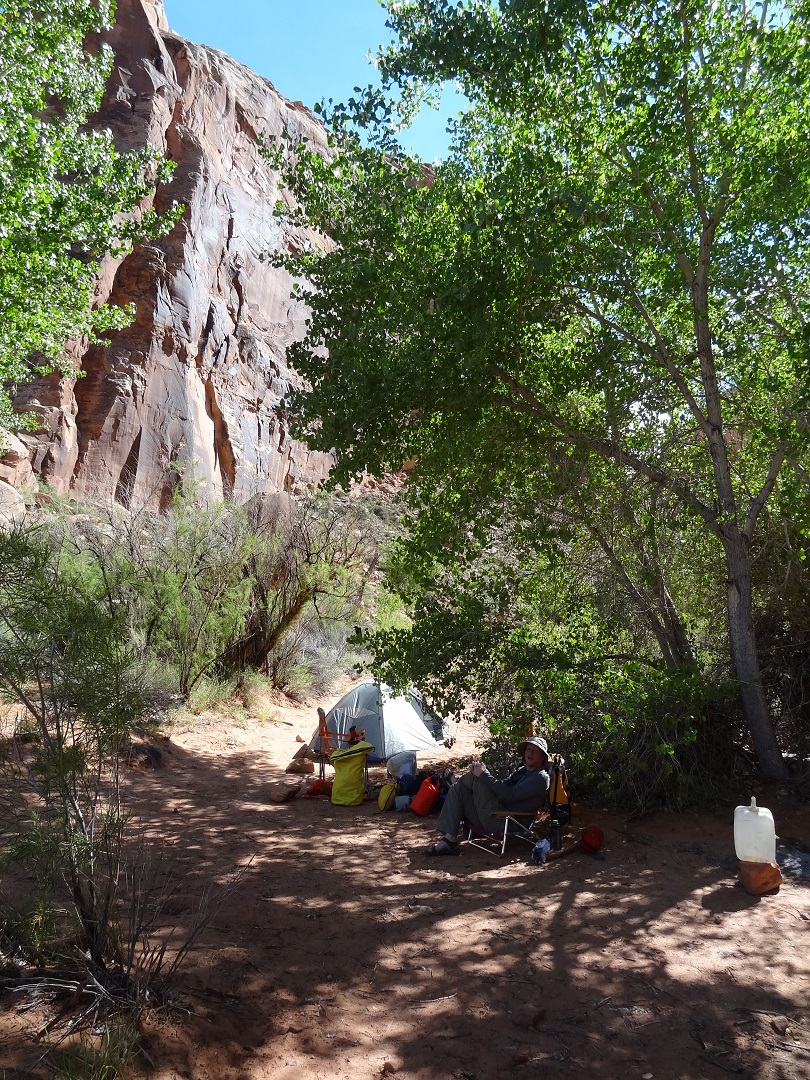
This was a great campsite with several cottonwood trees and a nice flat spot for a tent and camp chairs. But, you don’t have to go many 10’s of feet before the shade is gone.
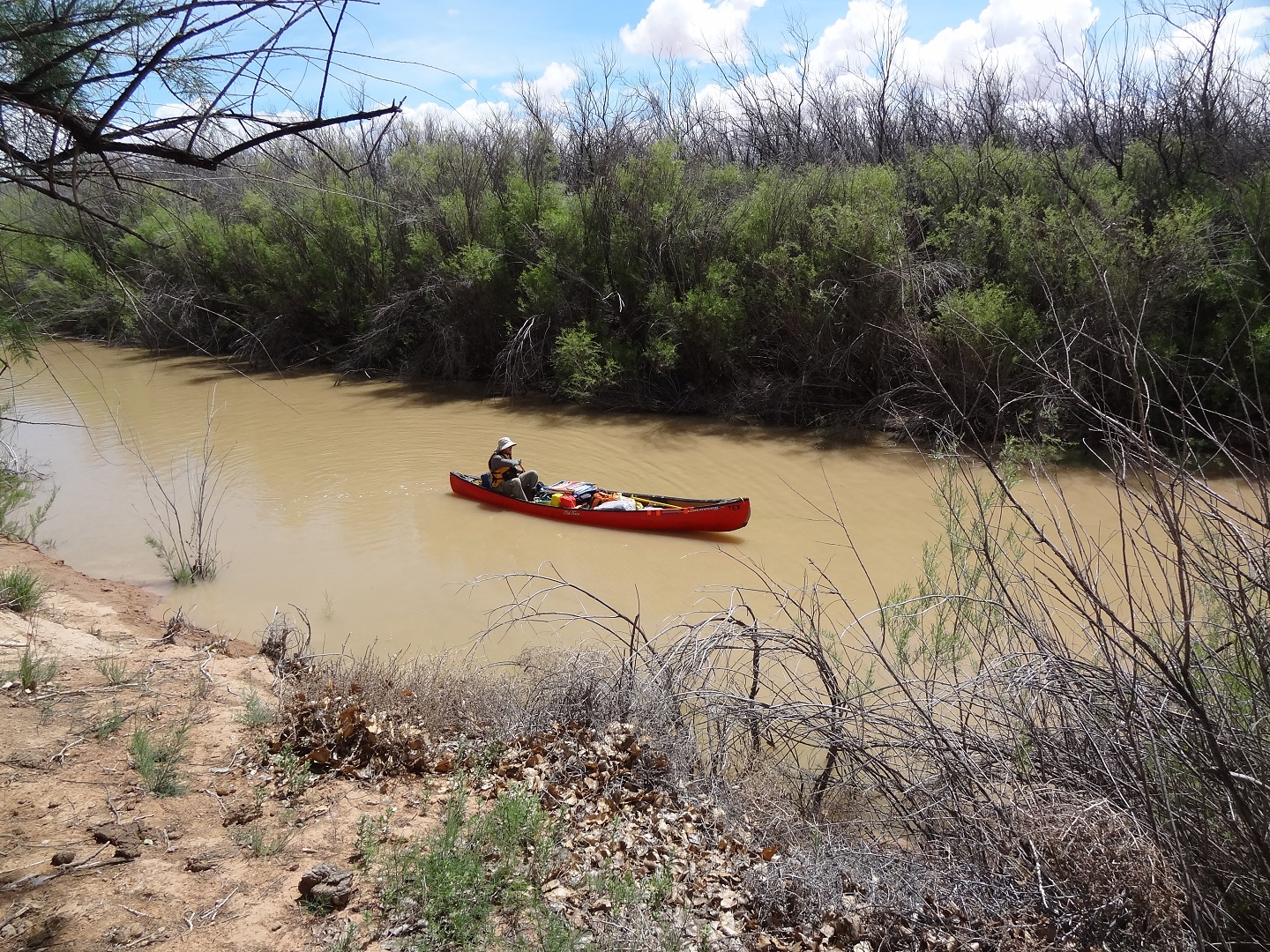
Dave hopped out to check out a possible camp spot while I kept entertained on this side creek for a bit. The canoe was packed full from thwart to thwart, gunwale to gunwale but not piled high. This gave me a nice view for the whole trip and meant less junk to haul in and out of camp every day.
A gorgeous view of the layers of rock along the Green River. This is hard to beat!
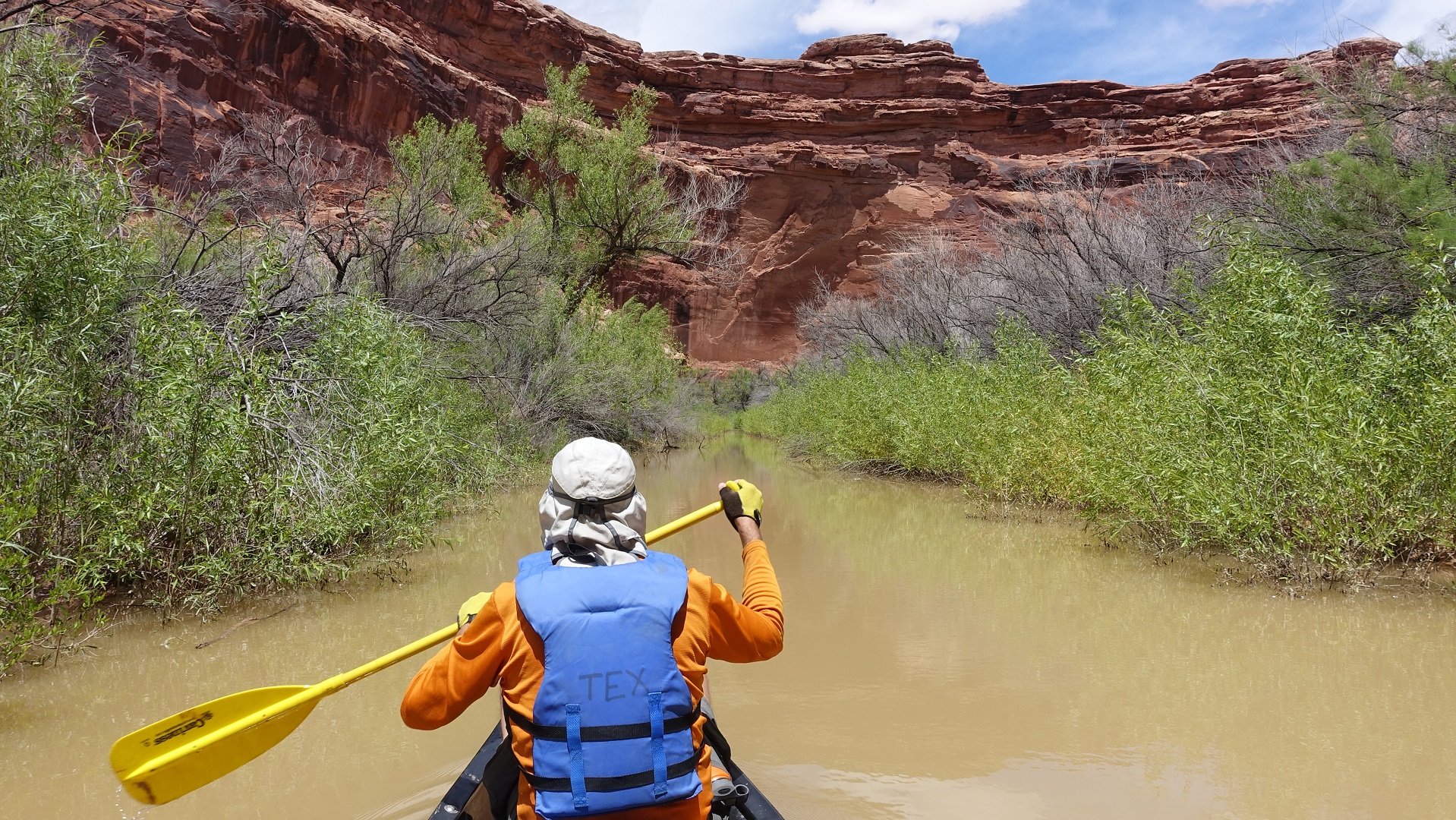
This gives a better idea of what it’s like trying to find a place to exit the river. This narrow side creek had cottonwood on one side, the trip was seeing if we could find somewhere to get out. Not only are the tamarisk very thick but the shore might be too steep to realistically climb.
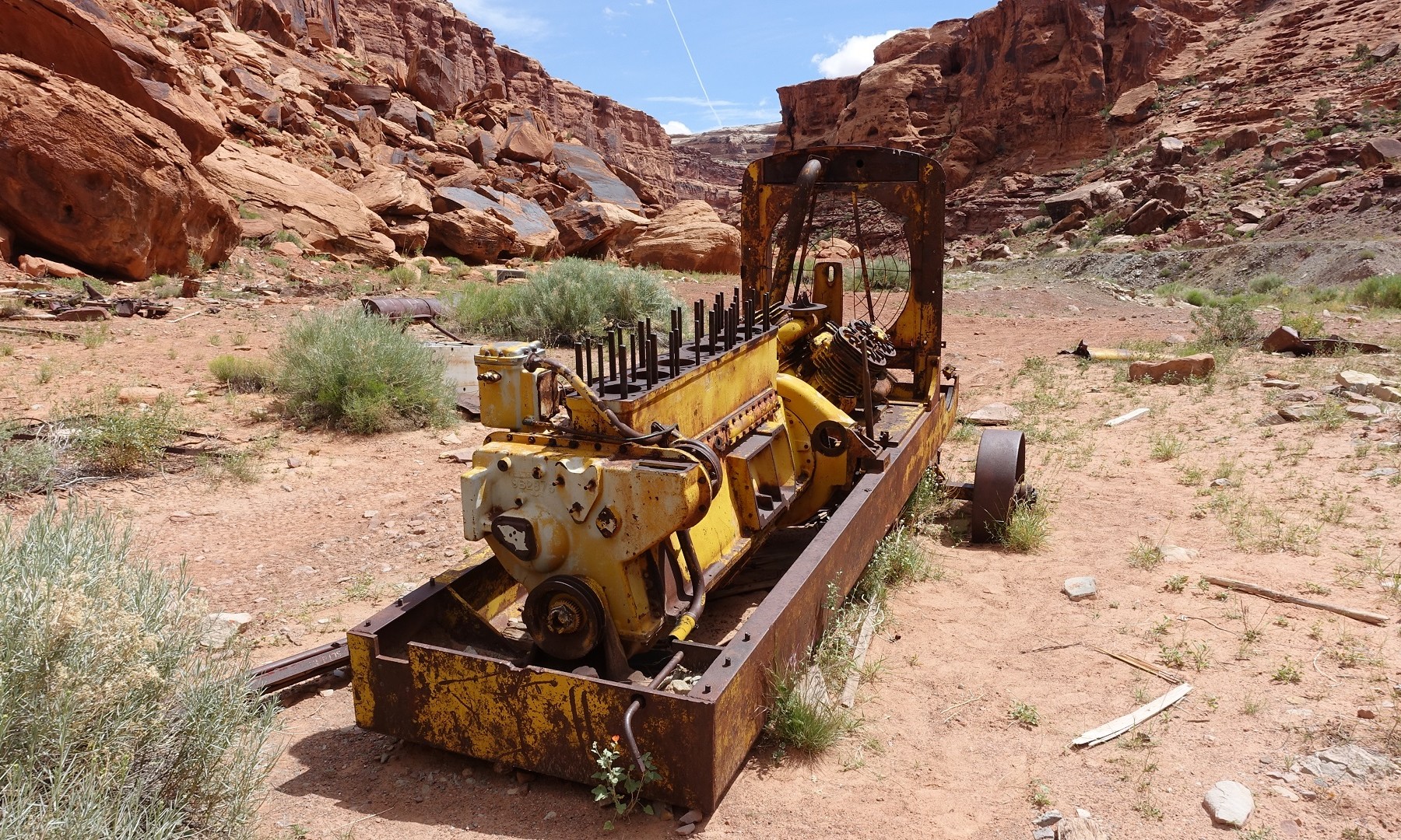
There were several uranium mines in the area that were active during the cold war era of the 60’s and 70’s. Most of these mines shut down because uranium was more economically viable elsewhere but there is still some old equipment and a couple of small mine openings visible in the area.
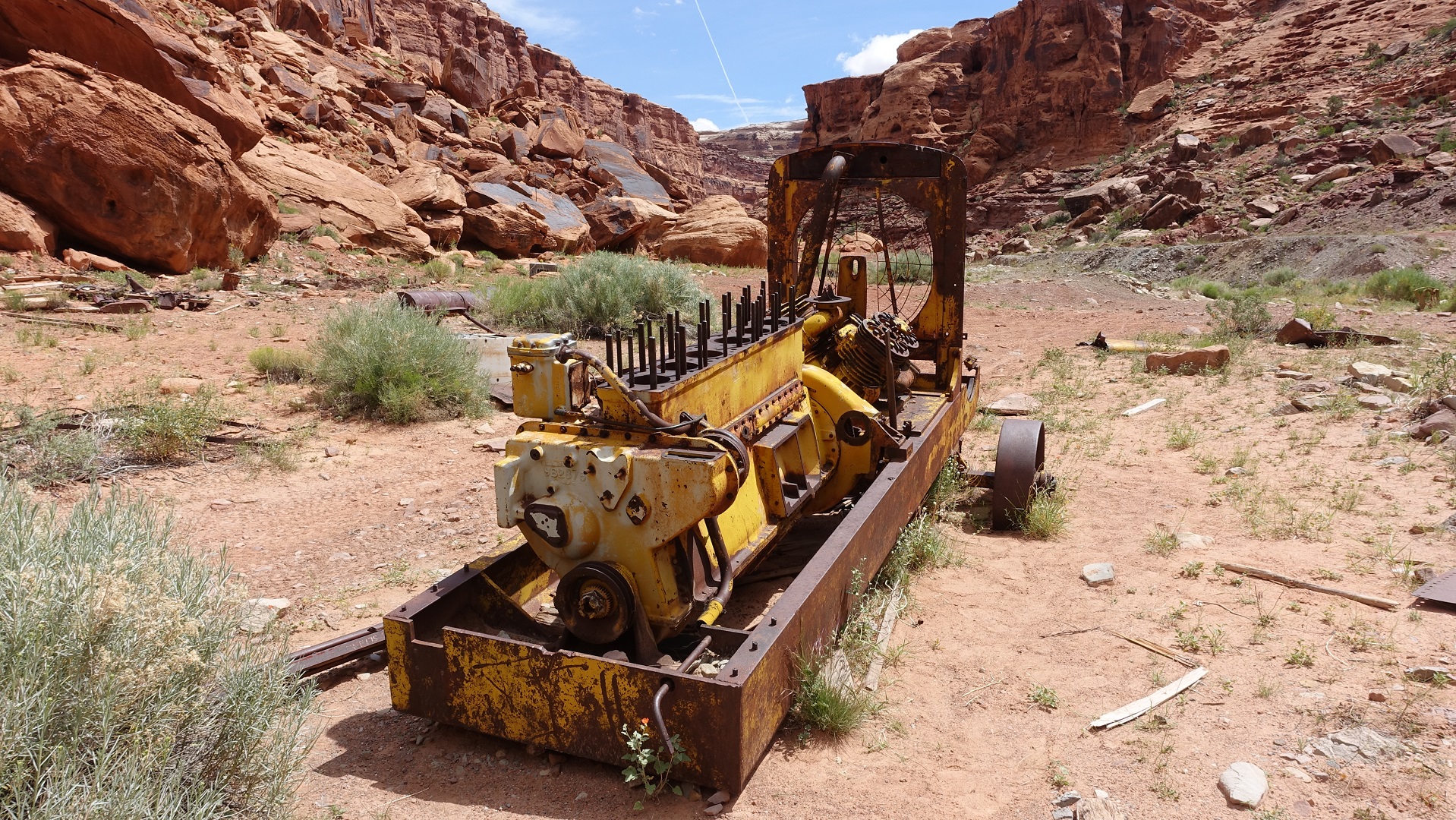
We had fun trying to piece together what each part of this machine did during its day.
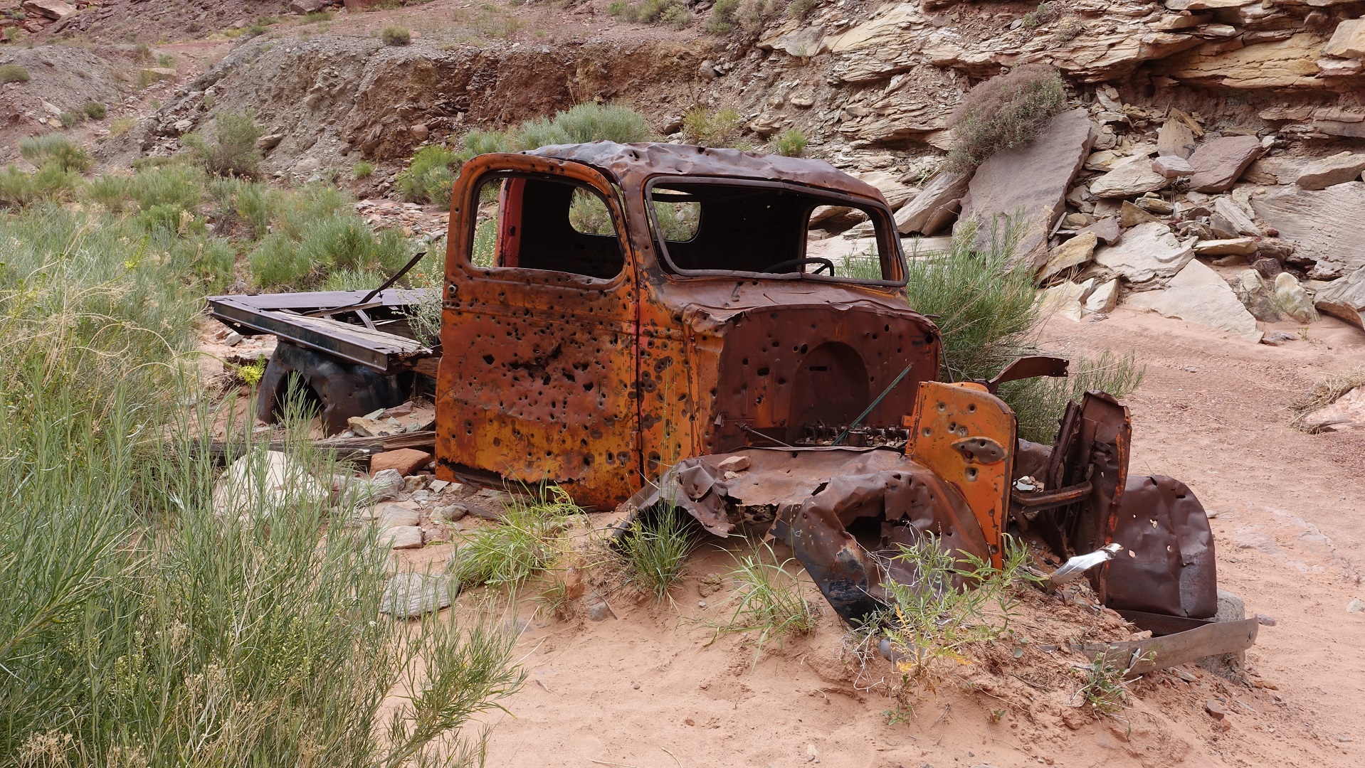
Frame-up restoration anyone?
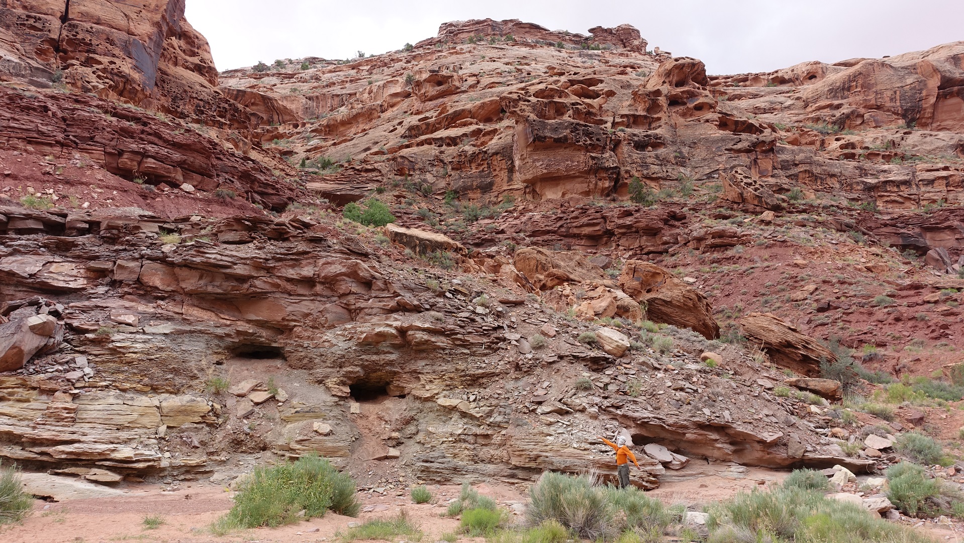
Dave pointing to a couple of mine openings we checked out.
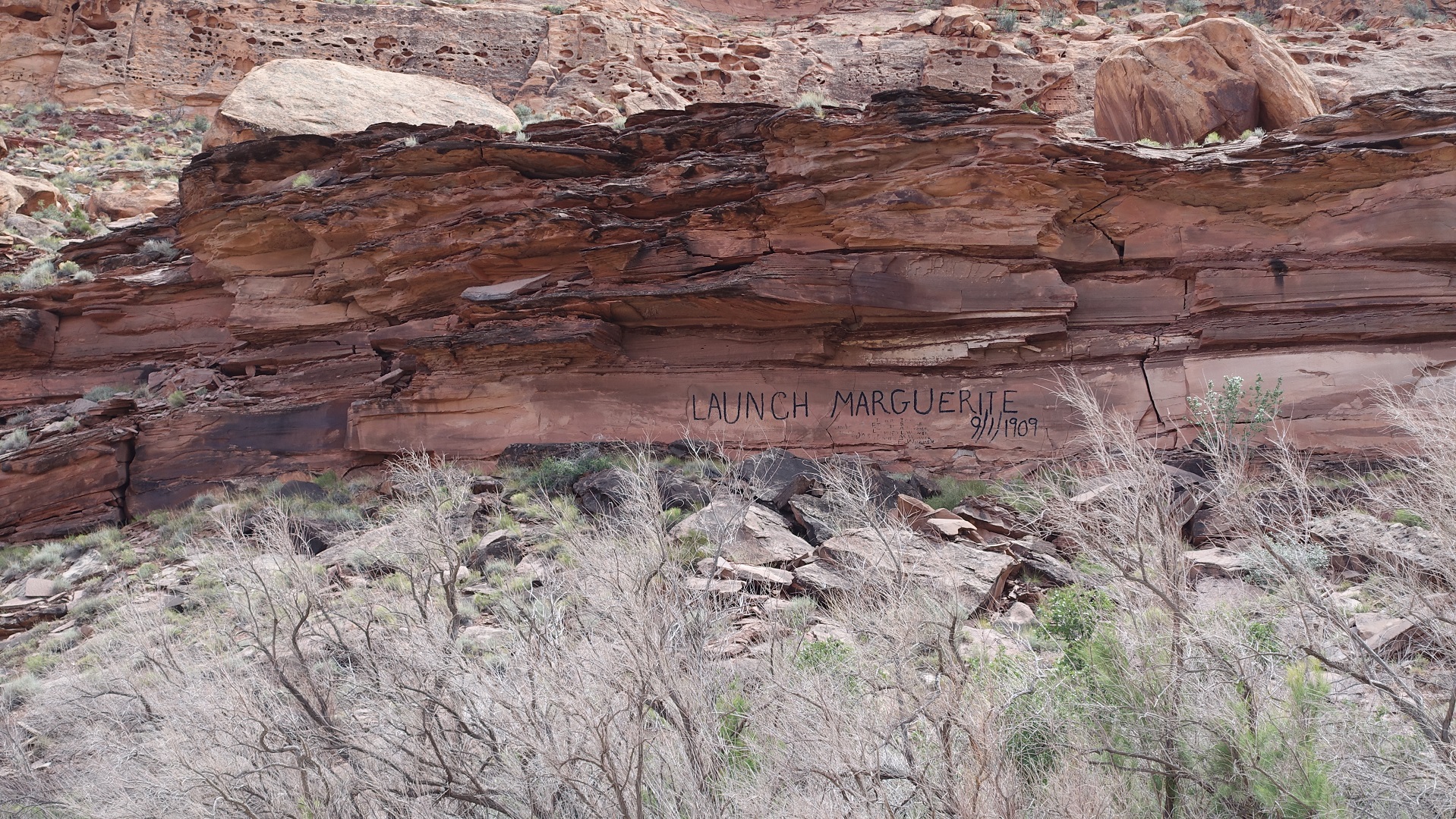
Inscription from a steam boat crew that explored the area in 1909 for fur trapping, It’s hard to imagine this was an area rich enough in fur to warrant such an investment in time and resources.
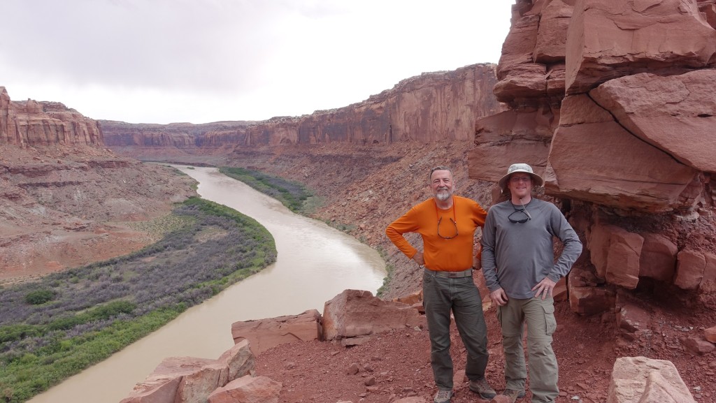
We climbed up a pretty steep rocky slope to get to this ridge, situated in a U-turn of the river. It was windy as heck and rain was coming so we had a quick celebration and then danced back down the slope.
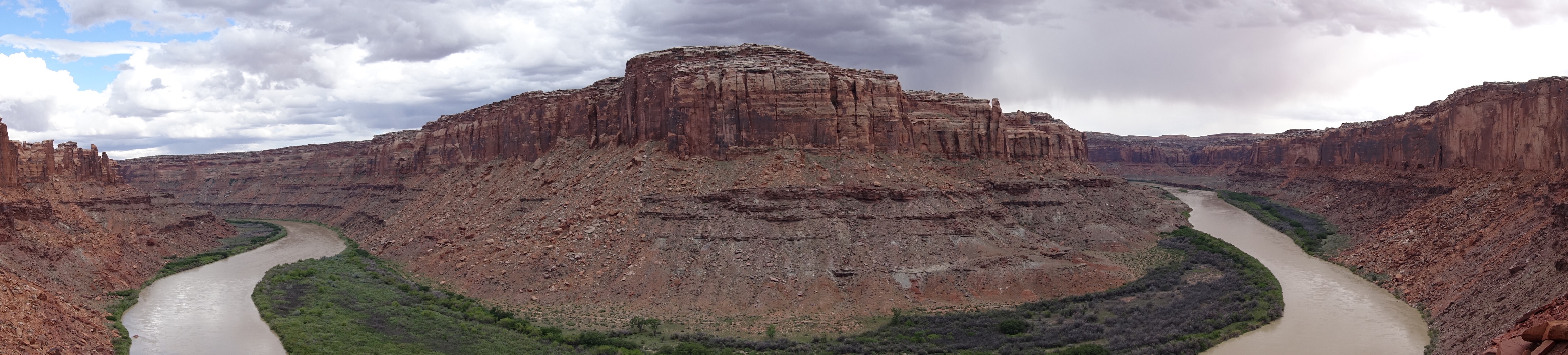
Horseshoe bend in Labyrinth Canyon. (I’m wanting for a little more wide angle on this one!)