Copyright © 2026 · All Rights Reserved · Ray's Travels
Swell Lite from Organic Themes · RSS Feed · Log in
Day 22, 9/8: Mesa Verde National Park
TAT Mile Marker: 2,454
Total Trip Miles: 4,198
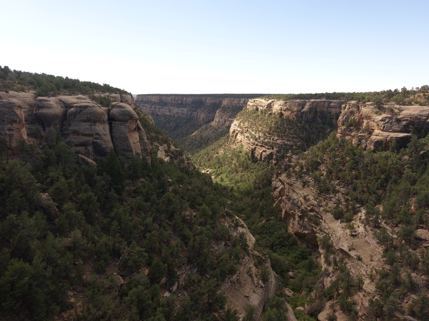
Up early, packed up and riding the scenic drive at 8am it was chilly and the sun was coming from the east, casting shadows across much of the valleys of Mesa Verde. The park encompasses over 50,000 acres and is around 7,000 ft elevation, higher than the surrounding area and features a lot of long, parallel mountains and valleys across its terrain. The shadowed valleys needed to wait a few hours for good pictures but I snagged what I could on the one way trip out.
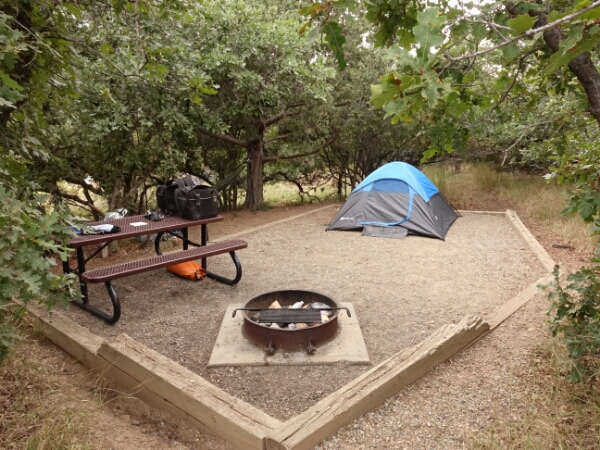
Very nice campsite tucked into the juniper forest
There was a nice winding walkway to a fire watch at one overlook. The path was bordered with cool shrubbery that had these barren branches sticking out above.
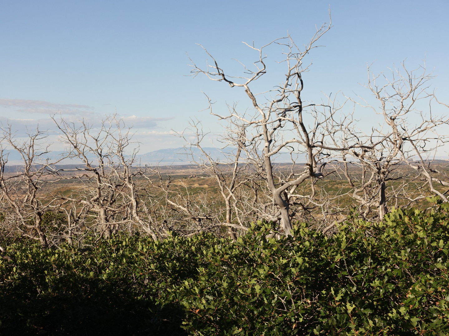
A walkway from the road to an overlook had this interesting shrubbery with barren trees sticking out above.
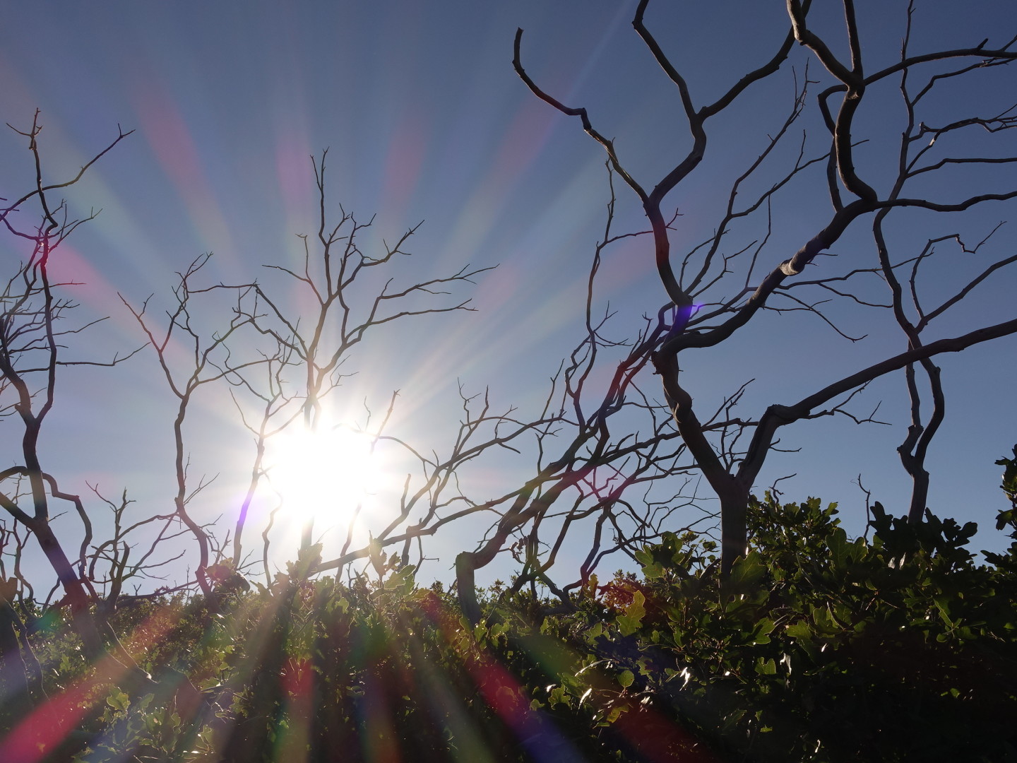
I really liked these trees for some reason.
There was obvious evidence of past fires that burned through the park. This area looked to have burned about 15 years ago.
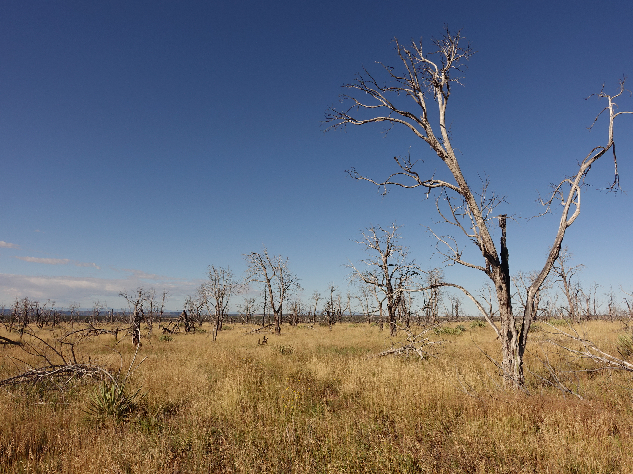
A past wildfire burned this area maybe 15 years ago.
The air was crisp and cool, I stretched the ride out to almost an hour before I reached the museum. Overall the exhibits and movies were well done. There wasn’t much new to me here really. I mean, there is always new and interesting stuff, but nothing that left an impact. They covered the history of people that called this area home, stretching from B.C. times with hunter gatherers to 1000 A.D. with native American Indians that grew crops and livestock and supplemented with wild plants and animals.
I’m not sure why, but native Americans were incredibly slow at developing technology. They were isolated from other cultures and all, but man, Alexander the Great had Damascus steel a thousand years before native Americans were weaving baskets, no? I’m thinking that, left alone, they might just be finding iron ore today as opposed to running casinos and using cell phones. I guess there are sensitive people that would interpret that statement in offensive ways but I’m relating more to the concepts in Guns, Germs and Steel which you should watch or read if you haven’t already.
One cool note from the museum is that corn can be a viable seed for 70 years if stored properly. Here are some corn cobs dating to over 1500 years ago.
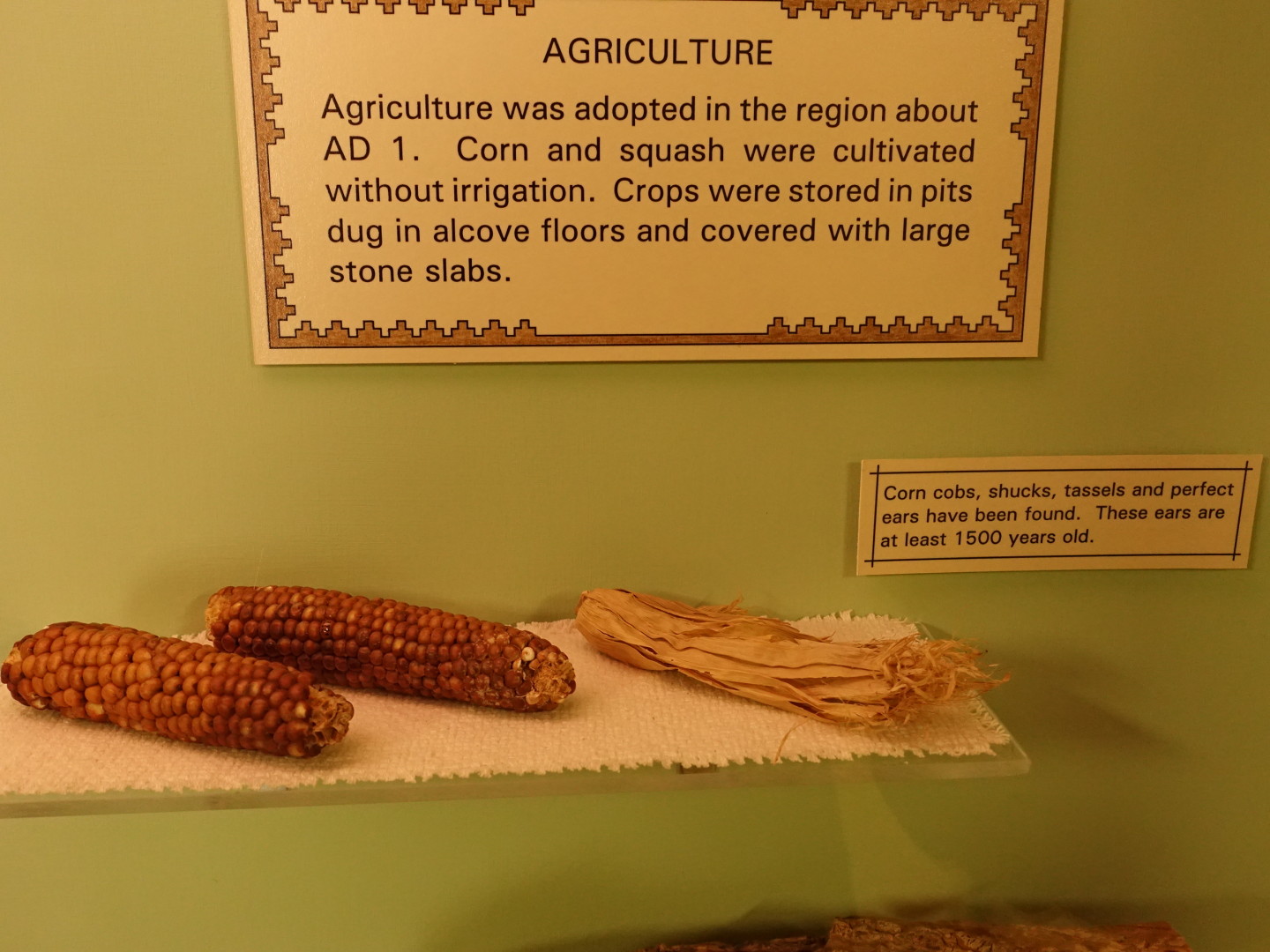
1500 year old corn cobs?
There was a very cool display on dendrochronology.
After the museum I snagged a ticket to a tour of the Cliff Palace, believed to be the largest cliff dwelling in North America. With 15 minutes to spare I grabbed a mediocre and overpriced grilled chicken sandwich with veggies. Real food was good nonetheless. Then I rode over to the tour meet up spot. The sun was much higher now, allowing for some nicer pics of the valleys. I also passed a small herd of horses!
Rising higher in the late morning sky, the sun was casting nice lighting and shadows before the tour started.

I passed a pair of wild horses as I rode. This one posed for a quick picture.
Our tour guide seemed well educated on the history of the people of the area. He did a great job of engaging us with story telling and questions. He gave a good perspective on the fact that almost everything he told us was speculation; they didn’t have iron and also didn’t have written history.
Anyway, the cliffs were big and pretty cool. Larger than what I’ve seen before for sure and we got to actually walk around in them which was nice.
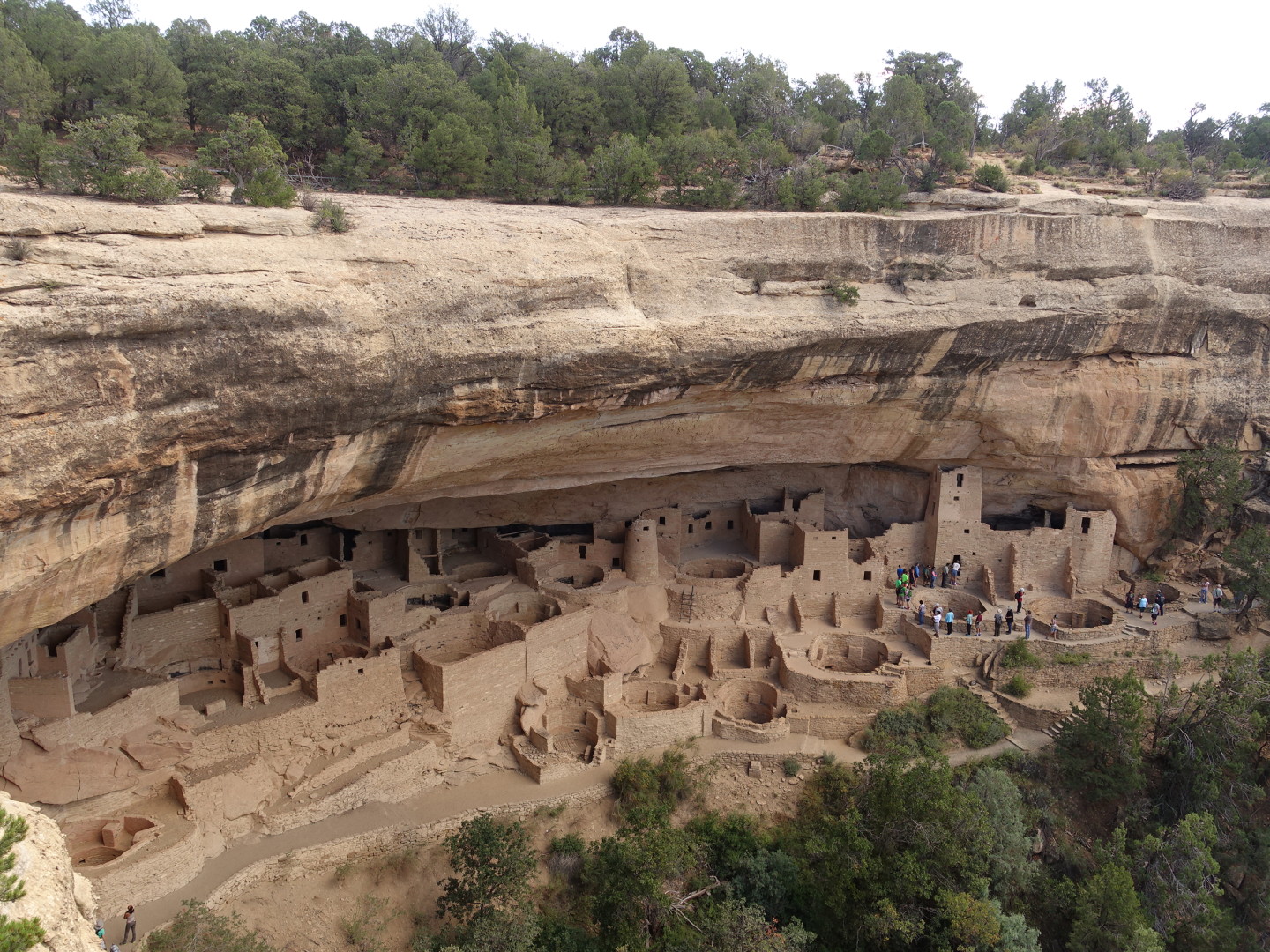
Cliff Palace at Mesa Verde National Park
Archaeologists speculate this artwork relates to weather.
So, this visit turned out to be a little more of a “checked it off the list” than a super exciting visit. That’s very rare for me at a national park. I was glad I knocked it off while I was in the area. Onward!
Sitting at 7,000 ft elevation the park rises well above the surrounding terrain to offer expansive views.
I hit the road, over to Cortez to get shoelaces for my boots (one failed), groceries, top off on water and drive north to find the trail. It was nice to be back on the trail, the mountains off in the distance teasing me.
The mountains tease me.
I rode until an hour before sunset, pitching camp in a clearing in the La Sal mountains at a little over 8,000 feet. Quick dinner, read my book, in the sack as soon as the sun went down, it was getting cold quickly.
At 2:15 am I was awakened by the sound of a hoofed animal outside my tent. I made a stirring noise and heard two creatures bolt away.
——————————
Day 23, 9/9: Trouble on the Trail
TAT Mile Marker: 2,659
Total Trip Miles: 4,469
I woke before sunrise but stayed in the sleeping bag to stay warm for a bit. Sun up I grabbed a bar, packed camp and got on the road by 8:30.
The La Sal mountains are really cool. East of the mountains I was in a fairly barren desert. Ascending yesterday I found dense evergreens at elevation. This morning I crossed over 10,000 ft and then descended to Moab at 4,000 ft with slick rock and barren desert.
This morning’s Initial riding took me through various evergreen and Aspen groves.
Very nice scenery as I rode at 10,000 ft, near the tree line.
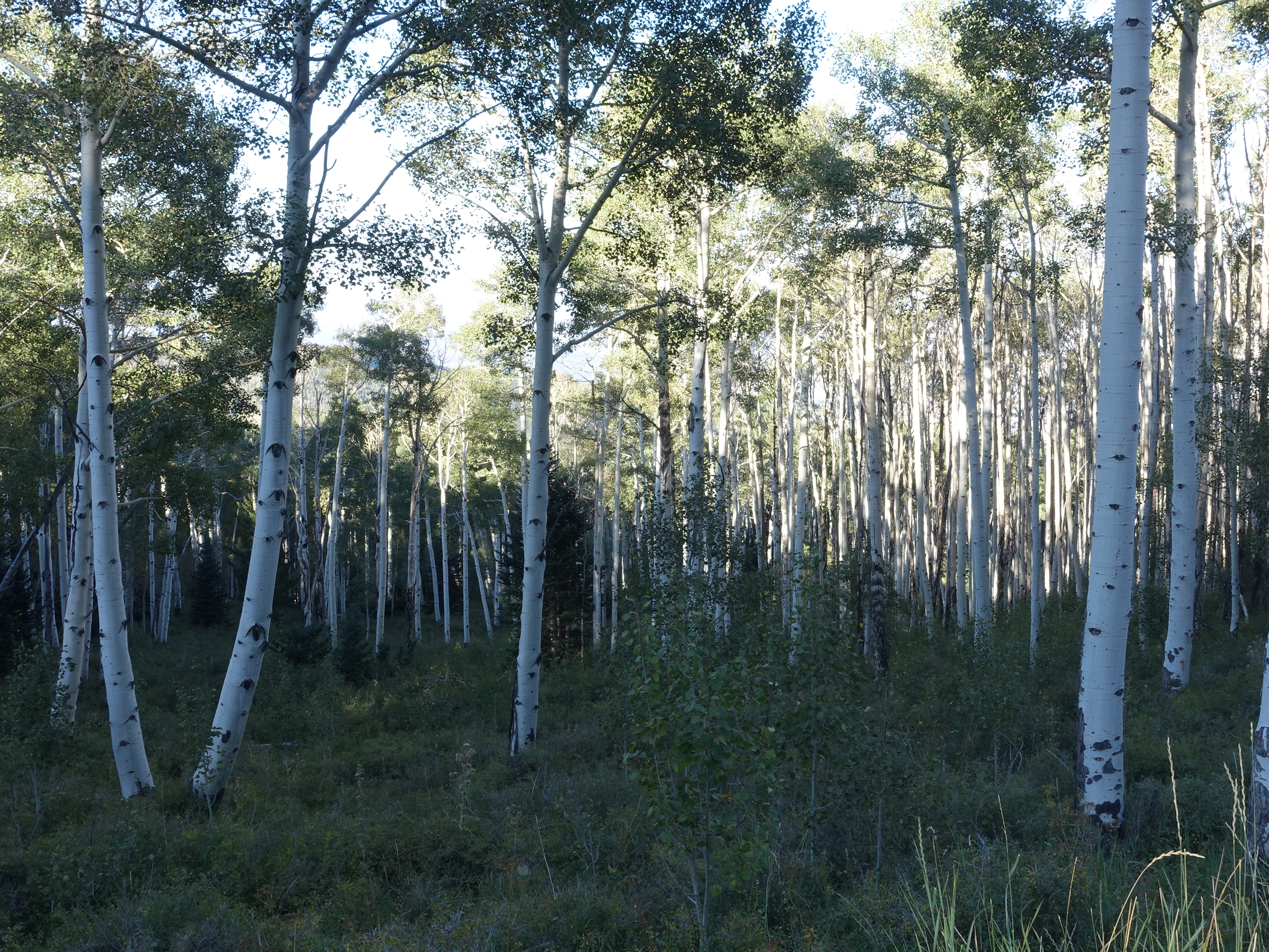
It’s amazing how thick these aspens grow in the high desert.
Not long after starting to descend on the west slope I could see the mountains were coming to an end.
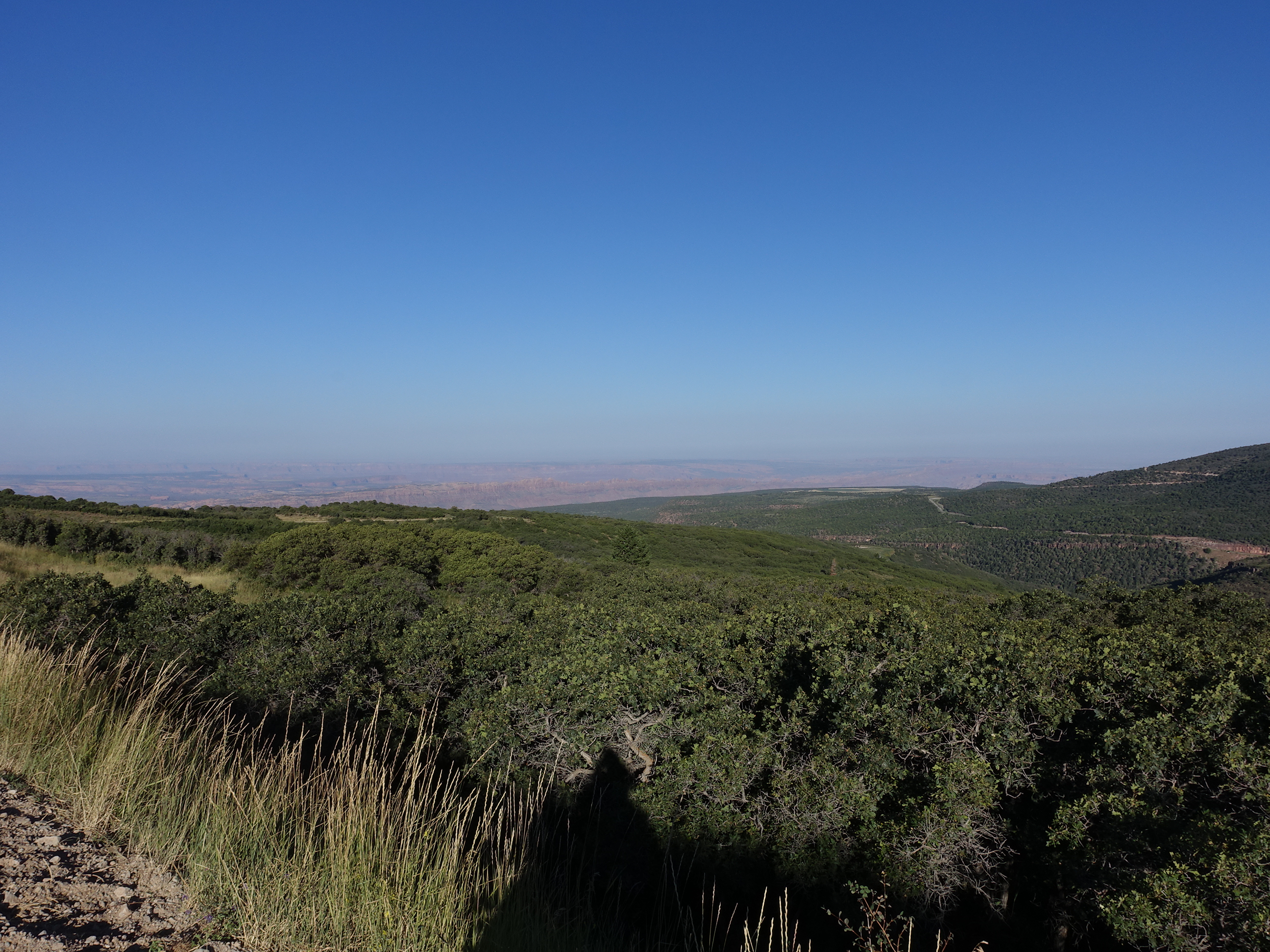
This transition from high desert mountains to 4,000 ft desert red rock is nearly upon me.
The rock quickly turned into the classic red, eroded sandstone – Moab terrain.
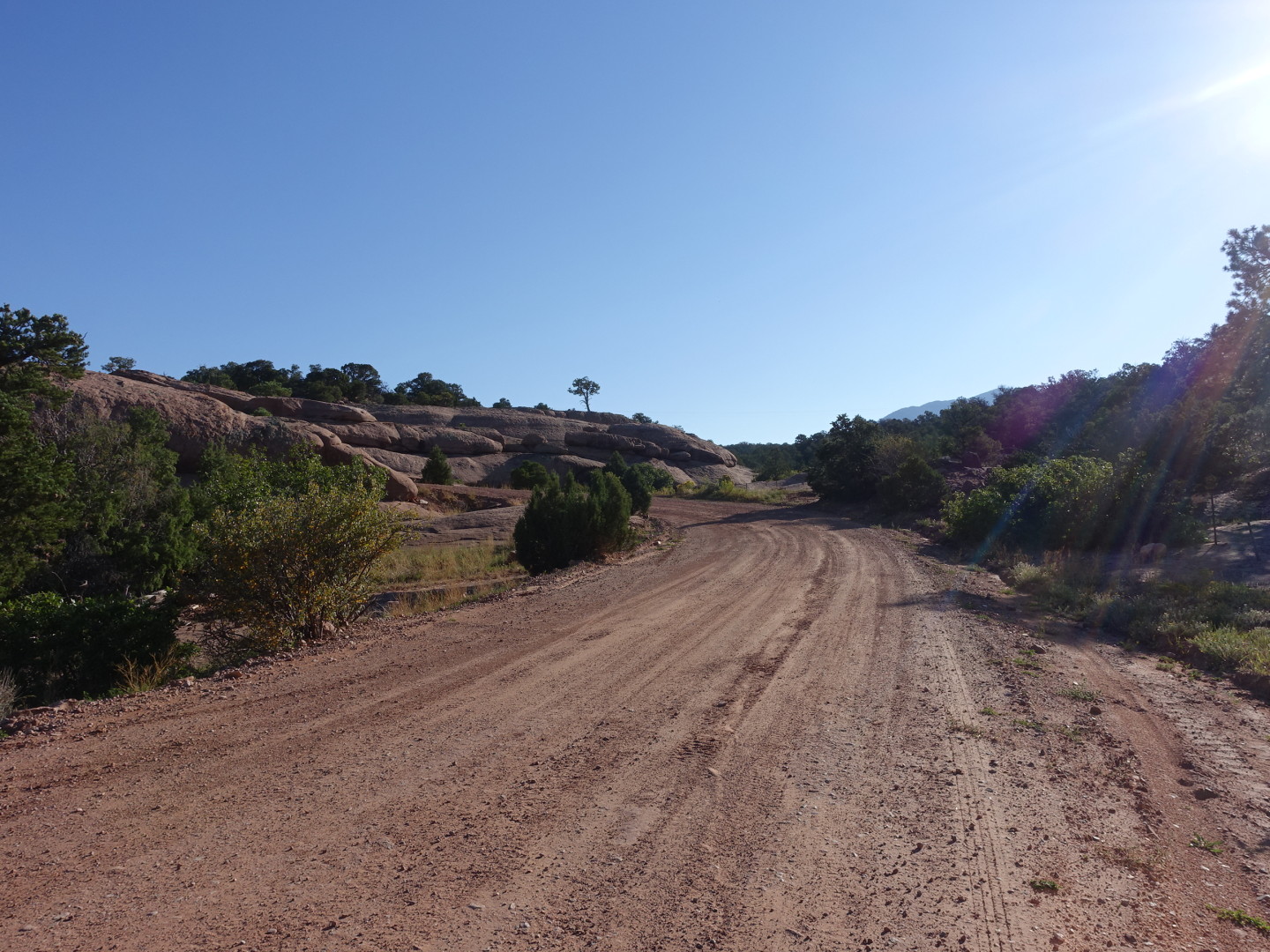
Yep, it’s looking a little bit like Moab (sung to the Christmas song).
Turning a corner I head and felt a “clunk”, “chunk, chunk” and pulled over. Looking back I see trouble and let a loud four letter word escape.
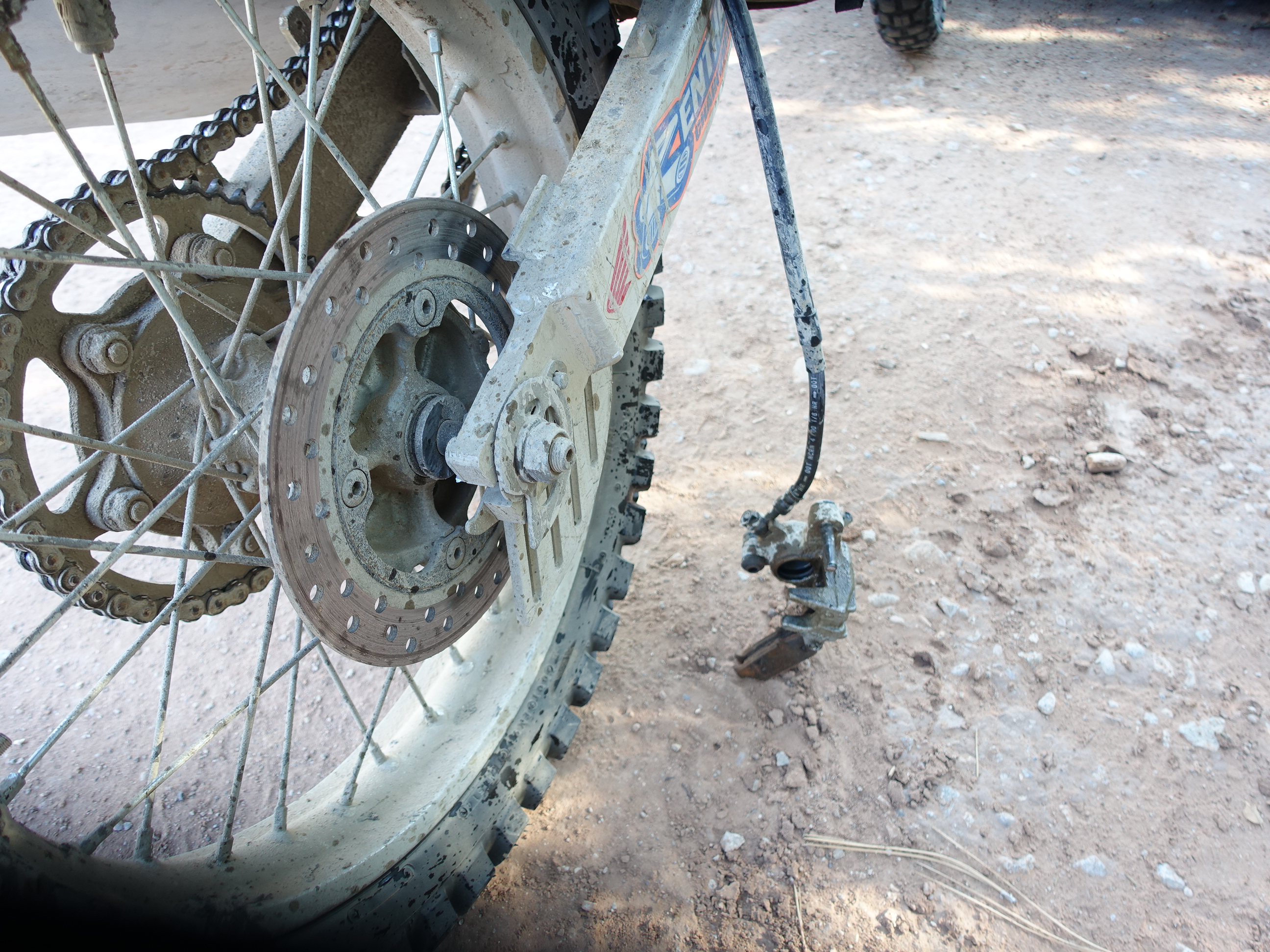
If this is going to happen, I’m very lucky it happened only 14 miles from Moab. A few thousand feet to descend (carefully) and then figure out what to do. I finally used two some of the zip ties I’ve been carrying around for 15 years.
Fearing I would be stuck in Moab for a week waiting on parts I zip tied the caliper to my swing arm and made my way down very, very slowly. No rear brake means stabbing at the front brakes to quickly slow down, a great way to end up wrecking.
I rode to Arrowhead Motorsports, as planned, to get new tires and tossed in an oil change while I was there. He looked at the brake and said it would be at least a week to get parts in. I looked at the parts diagram online and called a dealer down the trail to place a parts order and get a service appointment set up for Friday afternoon. Let’s hope it works out. Until then I’ll ride slow and easy.
Arriving in Moab I went south for new tires, a smaller front sprocket and an oil change at Arrowhead Motorsports. Parts were going to take over a week to get in so I looked at a parts diagram and ordered the stuff I thought was missing or broken from a dealer in western Utah. They gave me a service appointment Friday afternoon so the impact will be minimal. Fingers crossed I got the right parts and I don’t eat it on the way out there riding with no rear brakes.
I then got groceries, gas for the stove, cash from an ATM, more zip ties, lunch, and filled my gas tank. On the way out of the gas station a lady chatted me up and gave me a small bag of goodies she no longer needed as she was leaving town to head home. It was like a 4 star care package: Trader Joe’s bars, mashed potatoes, freeze dried Mountain House, almond butter. To use an Appalachian Trail term, she was a trail angel. In an otherwise very stressful day this was one thing that went well.
I took off on the trail at 4pm with 100 miles to go. An hour down the trail I had gone 25 miles, a bit of that on pavement, and knew I wouldn’t get to camp in Green River by dark. Riding after dark alone, 30 miles from civilization, an injured hand, tired and no rear brakes. Not good. I took the next trail to payment and rode it to Green River.
Sitting in Green River I looked more closely at my route to the dealer in Richfield UT. I would have to ride a long, hard, full day (with no rear brakes) tomorrow and then slab it to the city Friday morning for my service appointment. I really wanted to arrive Thursday afternoon so they could look at the bike Friday morning and place any parts orders early enough to get them on Saturday rather than Monday. The scenery in Green River was nice enough but I was just here for 2 weeks in April, on the paddling trip with Dave. Looking at the map I noticed I could mirror image my ride and take on Capitol Reef National Park. Hmmm, sold. I swapped out my front sprocket in the parking lot, aired up my tires to max pressure, put an audiobook on and hit the road.
Capitol Reef was a long ride, I arrived at 9:15 to find the campground was full and there were no others nearby. I rode 12 miles to the nearest town and asked about a room at a motel. After hearing my sob story he dropped my rate from $99 to $65 so I booked the room for two nights, smiling for my second time of the day and crashed into bed without even a shower.
——————————
Day 24, 9/10: Capitol Reef National Park
TAT Mile Marker: 2,659
Total Trip Miles: 4,533
I slept until 7am, late for me, had a slow breakfast and was on the road about 8:30am. The views leaving the hotel were amazing.
When I saw this view as I pulled out of the hotel parking lot I knew this would be a very nice day, indeed.
The 12 mile ride to the park was phenomenal.
The ride to the park had nonstop gorgeous views.
This lone tree caught my eye
Arriving at the Visitor’s Center I scoped things out for the day, watched a great intro movie and hopped over to a Ranger talk on local geology. Sophie has an undergrad in geology and is working in an interpretive role until going back for grad school after which she wants to do interpretation and research. I wish Dave had been there, she knew her stuff. We’d probably have tied her up, kidnapped her and pestered her with questions all day.
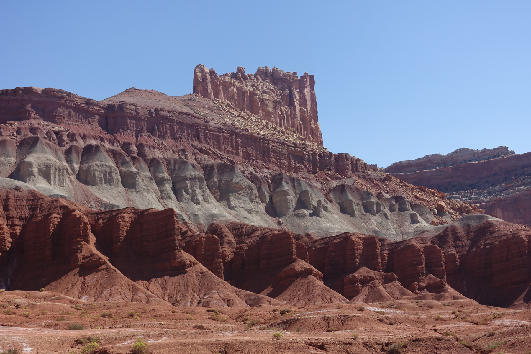
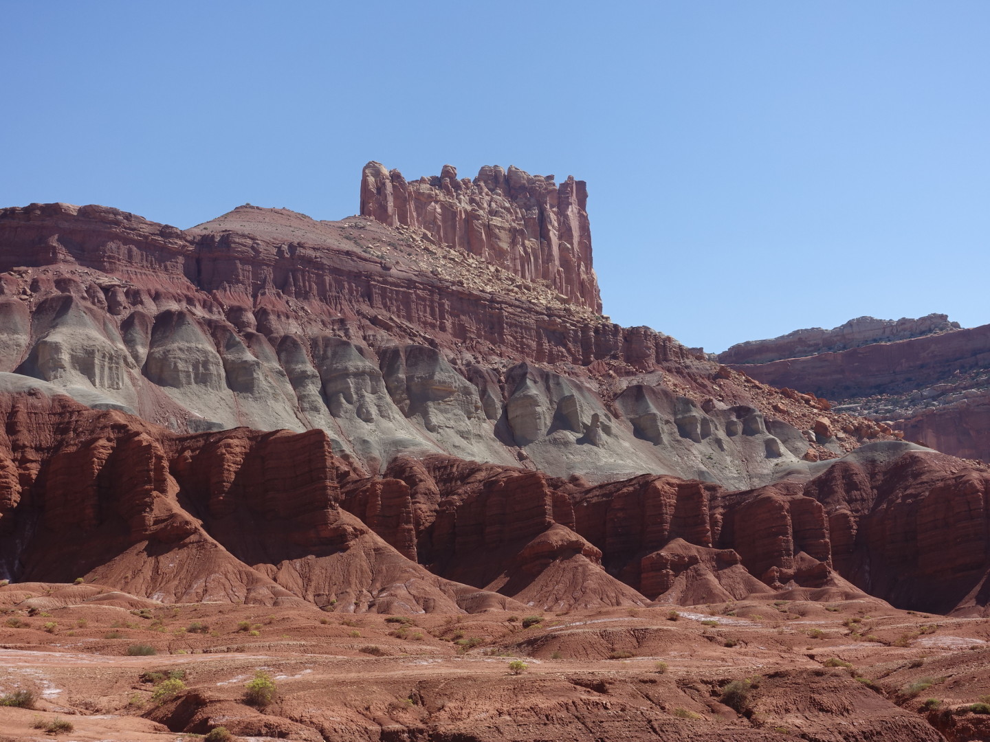
The key geological feature of the park is the 90 mile long “Waterpocket Fold”. 50 million years ago a fault activated causing the western side to rise 7,000 feet relative to the eastern side. The surface layers of some 10,000 feet of sedimentary rock were relatively pliable resulting in a smooth, unfractured terrain. Over the years this eroded to create the landscape we see today. Like the Green River paddling trip we took last spring, you can see 200 million years of geological history in one place as you view the layers.
This shows the layers that made up the visible geology of the Waterpocket Fold, Capitol Reef National Park.
The most interesting point to me was that the gray layer, often containing concentrations of uranium, is actually Appalachian mountain sediment. They determined this through zircon dating. We can use carbon dating back several tens of thousands of years, zircon (zirconium silicate) is good for dating rock to billions of years with 1% kind of precision.
Zircon is a gemstone that often forms with uranium in its lattice. Lead can’t form in zircon because it’s molecular size is too large for the gem’s lattice. Uranium decays into lead (half life of 4.5 billion years) however, so if you find zircon you can often determine the age of the stone by the uranium to lead ratio. They dated the zircon in this gray layer and it was so old that only the Appalachian mountains could be the source. Back in the day as the Appalachians eroded, an East-West river carried the sediment to Nevada where it was later blown into Utah forming this layer! The Appalachians may have reached 30,000 ft in their day, dwarfing Mt. Everest.
The other cool thing I learned is that uranium concentrates in this layer due to a redox reaction. When in an oxidizing environment uranium becomes mobile and is carried down through rock layers by water. When it hits a layer that reduces uranium, it precipitates out leaving a concentrated ore. I stopped asking questions at this point; I don’t think anyone else was following 🙂
There were many uranium mines in the area in the 50’s and 60’s but foreign sources of uranium were much cheaper to procure so these mines were shut down.
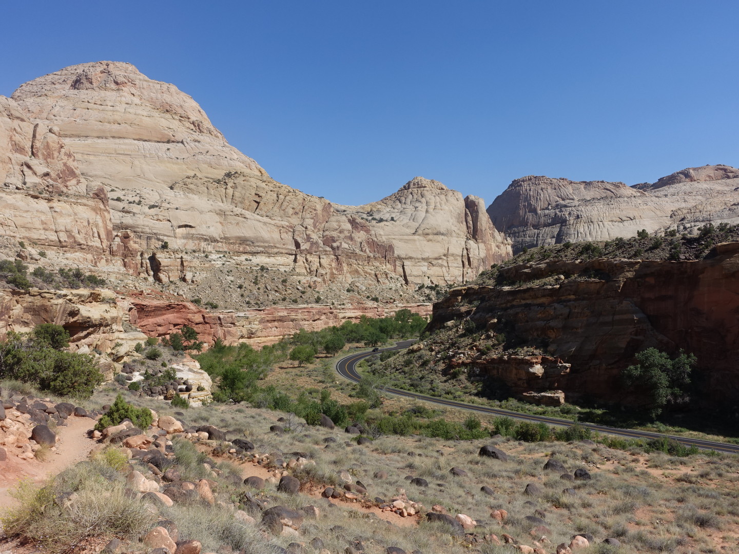
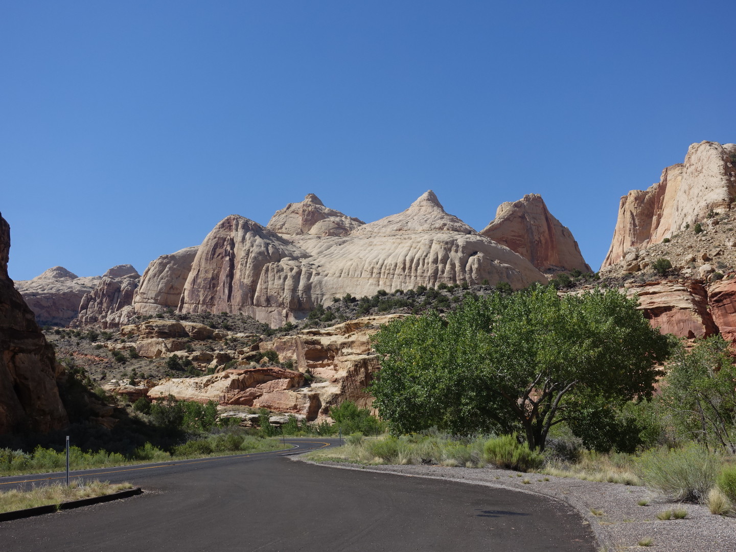
So, off on the scenic drive 10 miles one way.
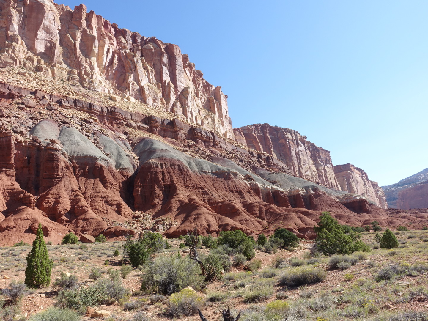
Nice view of several layers along with typical erosion patterns.
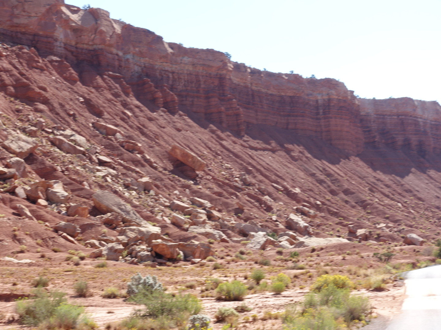
Very different erosion in these layers
This is the “capitol” that Capitol Reef National Park is named for
Arriving back at the visitor center I stopped for lunch in a very pretty picnic area.

This huge, gnarly tree kept me company and provided shade during lunch
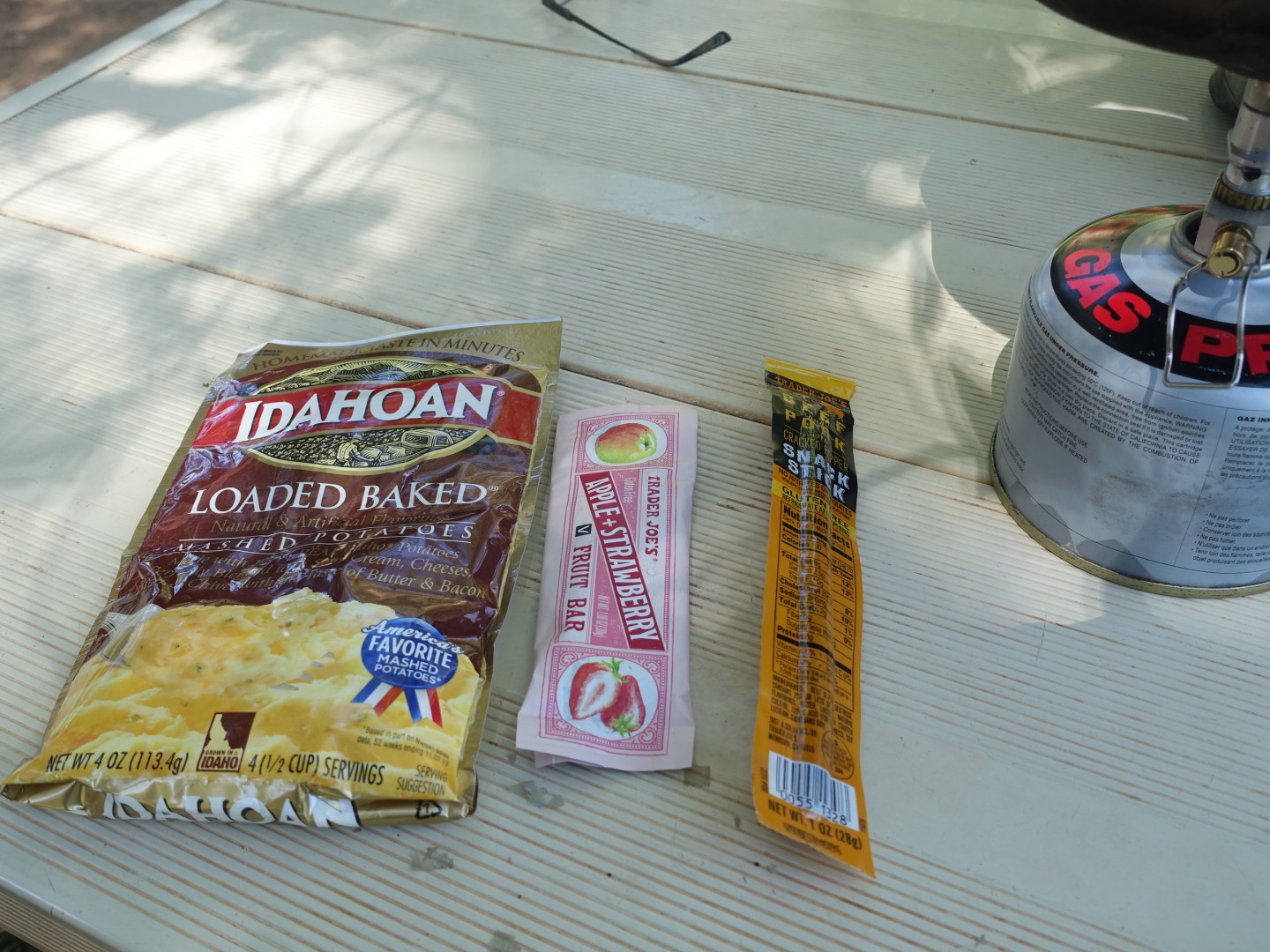
These mashed potatoes were awesome. Thanks trail angel!
Then some more scenic riding and hiking.
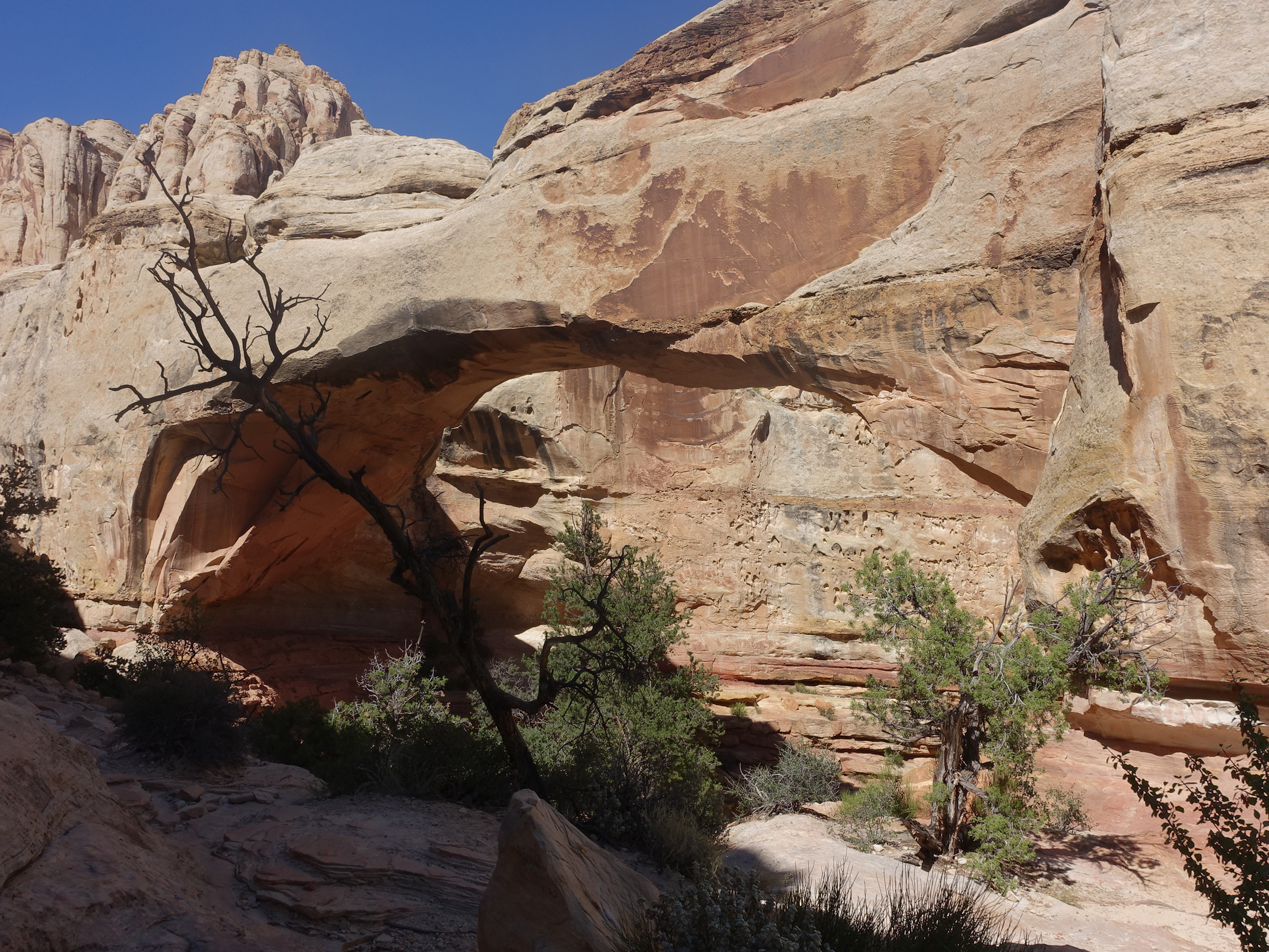
A pretty cool natural bridge halfway through a nice 2 mile hike.
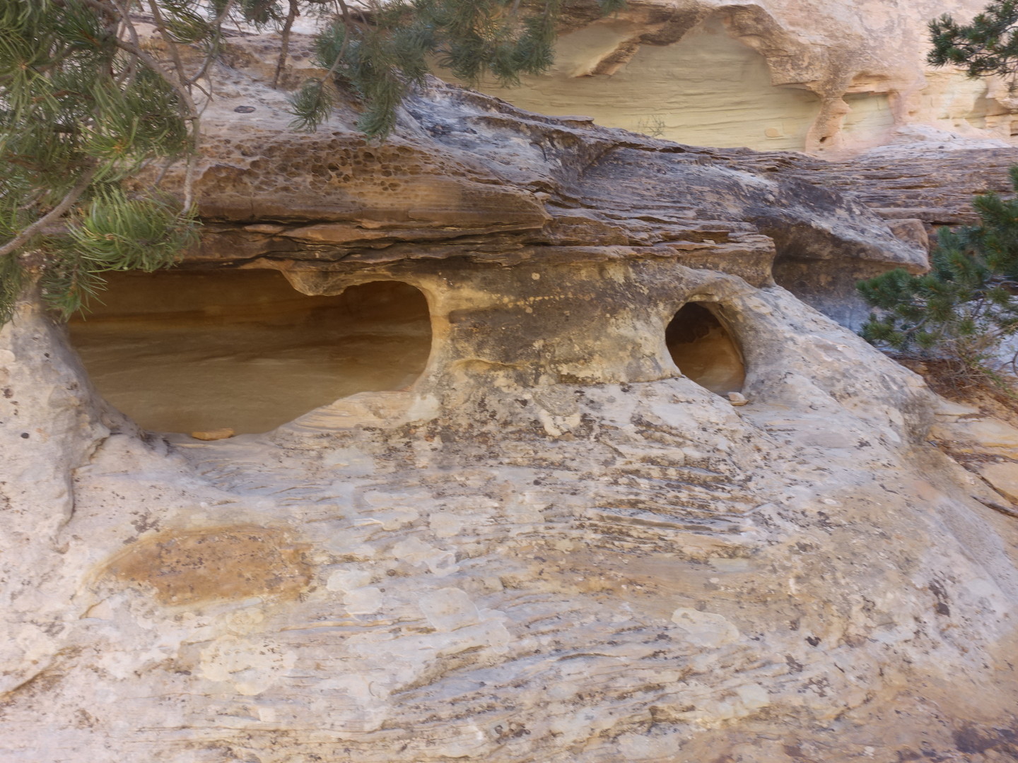
There were some interesting erosion patterns in the rocks.
Hmm, think there’s a river down there?
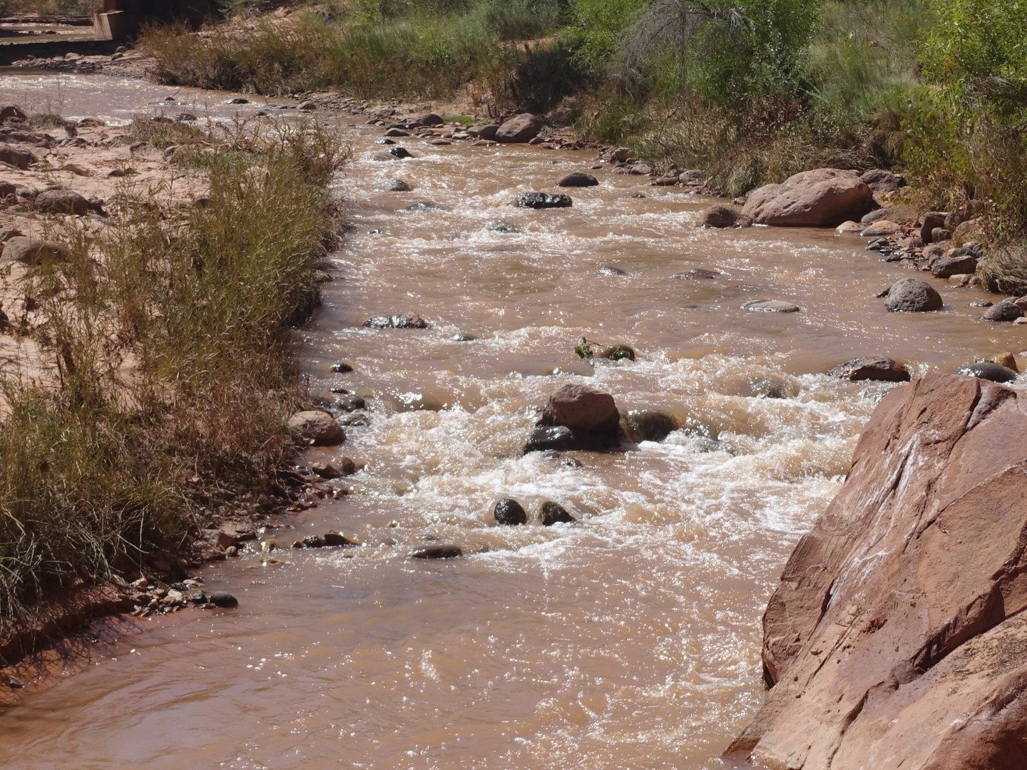
Yep, the Fremont river. This river along with other geological confluences created a very fertile area where up to 10 families lived. There are still fruit trees in the area that you can pick for a fee.
Inspiration for a future capitol building?
After a full day of sightseeing I headed back to the room to relax a bit, do laundry and get to bed early, fingers crossed that repairs the next day would go smoothly.