2015 Transam Trail – Overview
I’ll be taking off on the Transam Trail in a couple of weeks, assuming my most recent injury heals well enough. I’m limping around the house at the moment. This will be my most epic trip yet (though I plan to outdo it next year). A few stats of interest:
- Andrews, NC to Port Orford, OR (then I’ll ride back)
- 3,484 miles of off-road riding planned (one way)
- Approximately 4,300 miles of one-way riding planned once I add in the trip across North Carolina, gas/resupply runs and other diversions
- Round trip is expected to be around 9,000 miles
- I have planned for 2 months of riding and relaxing but the schedule is flexible
- The “trail” is made up of gravel roads, forest service roads, jeep roads, farm roads, abandoned railroad grades, and dried up creek beds
- Elevation will range from sea level to almost 12,000 feet with the eastern portion being <2,000 feet and the western portion being mostly over 5,000 feet
- I’ll be riding a street legal, off-road motorcycle, a 2001 XR650L
- Departure date: August 19, 2015
The three basic components of planning a trip like this are:
- Read about the experiences of others
- Get familiar with the route and formulate a high level idea of key aspects
- Any areas with long distances (>200 miles) between fuel stops
- Stretches at higher elevations that will be nice for spending time during the summer
- Particular points of interest along the way (National Parks for sure)
- Gear prep
- Get the bike ready for an extended, brutalizing trip, find and fix any weak spots
- Build a tool set and spare parts kit for trailside repairs
- Minimize the basic camping gear to minimize weight on the bike
#1 is done, mostly on the advrider.com forums
#2 I started yesterday though I’ve planned enough trips that a couple of days of immersion is probably enough, even for a trip this big
#3 has been heavily underway for the last 2 weeks
Route Overview
The trail is copyrighted so I won’t provide a detailed overview but here’s a high level overview of the whole route plus each state. Note that the elevation profiles are actually east on the left and west on the right, “backwards” compared to the earth view.
I only found one long trip between gas refills: 228 miles between McDermitt, NV and Lakeview, OR
The most likely problem areas are after Green River, UT where the terrain is difficult to ride in and to navigate, and Oregon where logging roads are often blocked and require a lot of rerouting. With 6.8 gallons of gas I should comfortably have 300 miles range (or extra gas if I get lost, find interesting roads to ride or get bogged down in sad and mud).
Full overview (4,007 miles, the TAT is shown in white and in the elevation profile and is 3,484 miles):
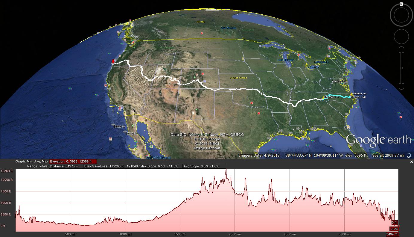
The one-way route, coast to coast, white being the Trans-America Trail, cyan my adder to get to the east coast
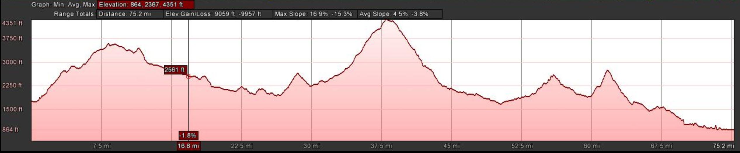
North Carolina, 75 miles
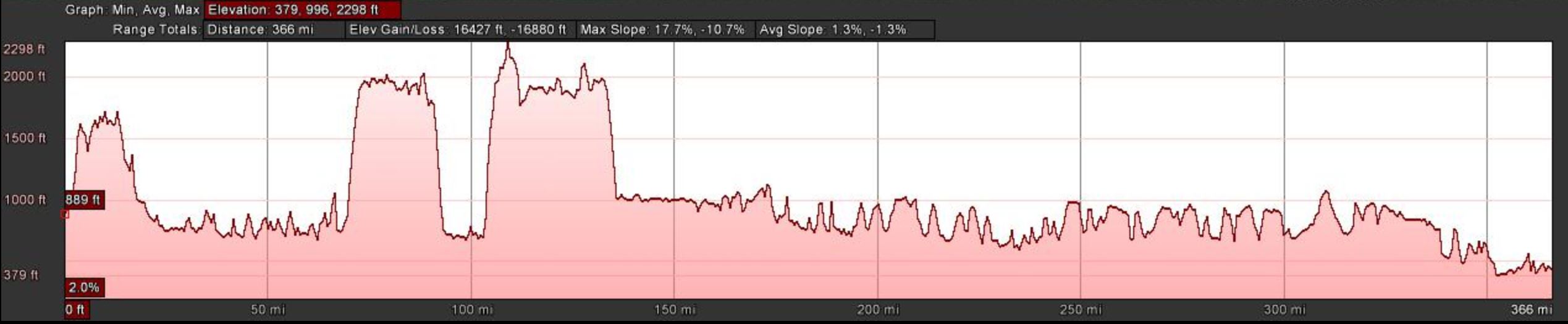
Tennessee, 366 miles
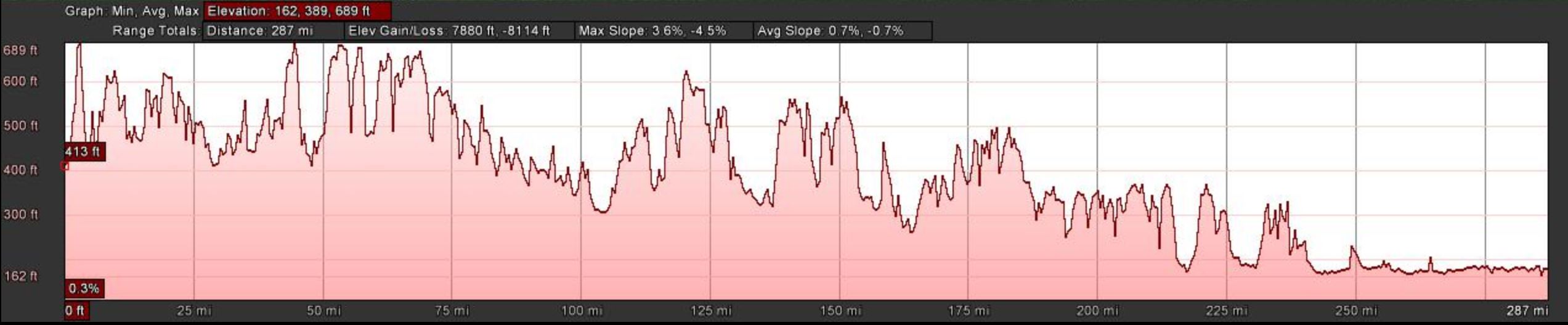
Mississippi, 287 miles – if you look at the scale you’ll see that while there is a lot of cumulative gain (7880 ft), it happens in very small increments
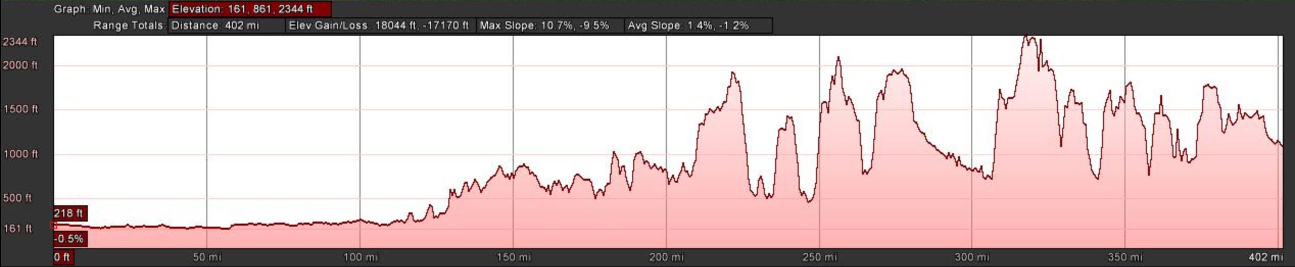
Arkansas, 402 miles
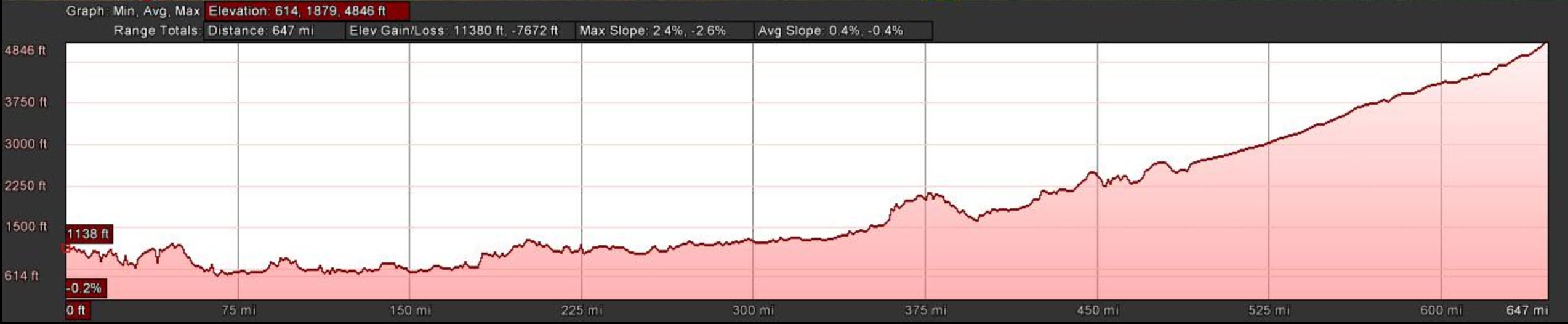
Oklahoma, 647 miles – the end of Oklahoma will feel nice and cool at 5,000 feet
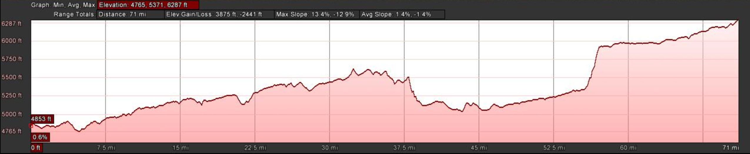
New Mexico, 71 miles
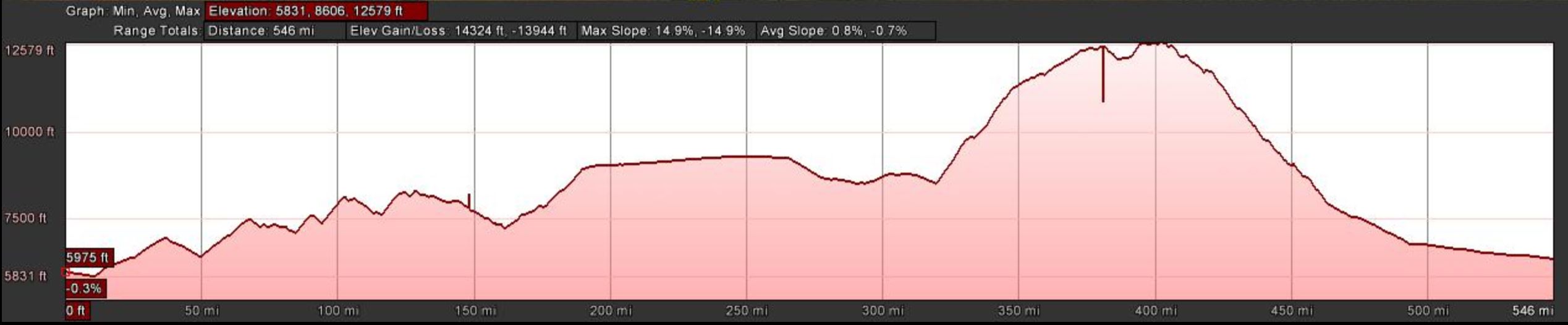
Colorado, 546 miles
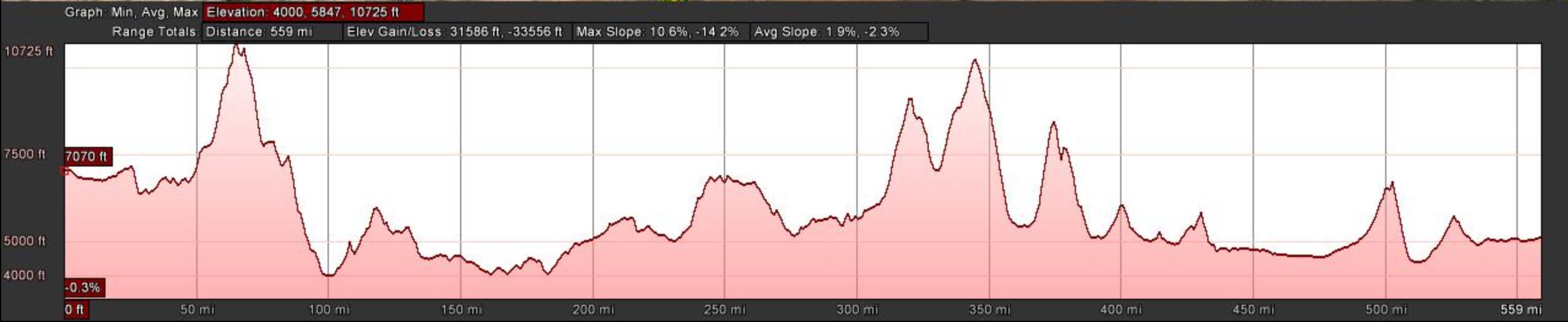
Utah, 559 miles
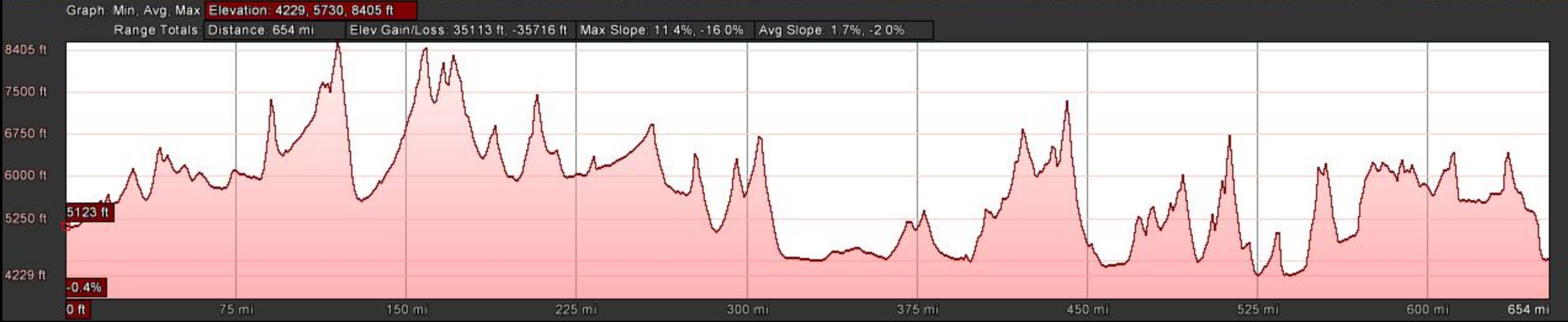
Nevada, 654 miles
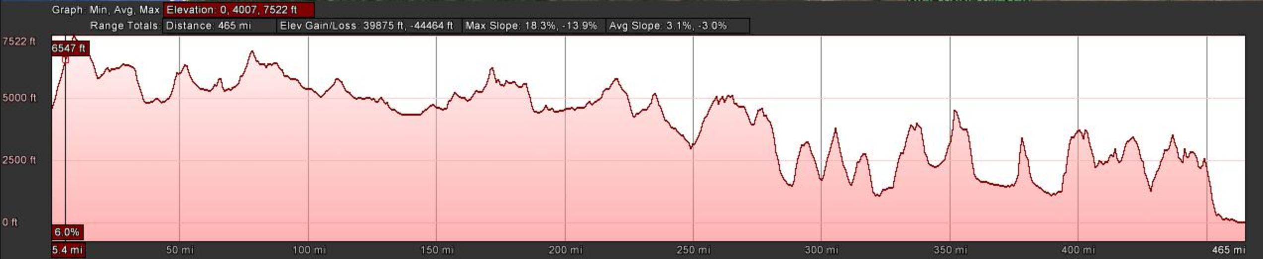
Oregon, 465 miles
Map Cards:
I’ve made map cards of around 200 miles each that show gas stops, mile markers and points of interest. An example:
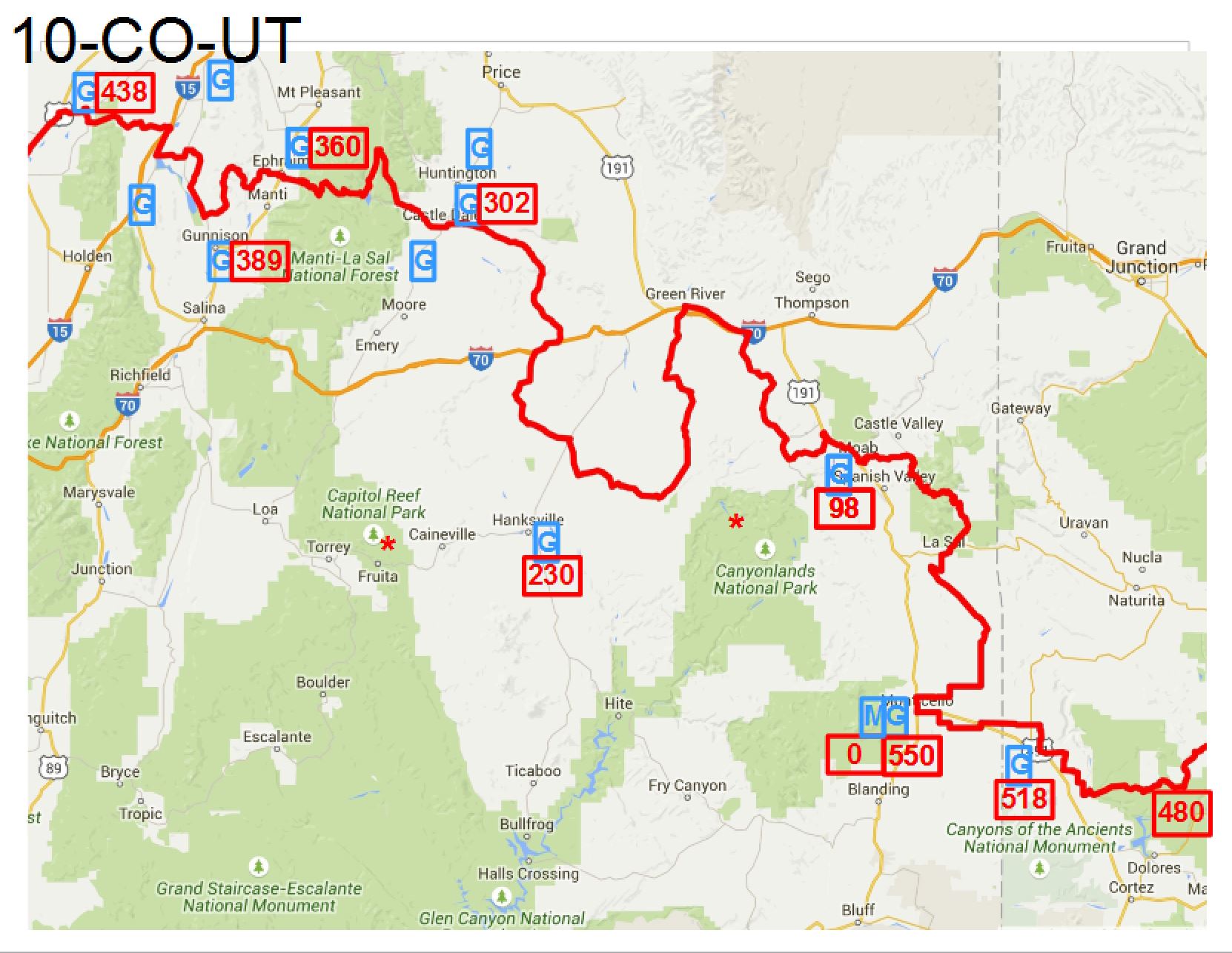
Sample map card showing gas stops, mile markers and points of interest
There are of course a lot more details than I’ll bother to post here, but after two full days of work I could head out the door tomorrow and I know what I’m doing.
The bike will be ready next week, I’ll post more then!